Showing posts with label Northwest Arkansas Trails. Show all posts

Tuesday, March 8, 2016

Iron Ranger Challenge: Miles 0-9 (Pea Ridge National Military Park - Horse Trail)

Greetings!

On Saturday, February 27, I set out on my first Iron Ranger trek of the year on an unseasonably warm winter morning. For my first hike this year, I chose to go to a new spot I have never visited in the Arkansas National Parks, Pea Ridge National Military Park. Lucky for readers, Johnnie has already visited this spot before and has prepared a write-up for a forthcoming guidebook. I will be including his notes for details about the trail itself.

The short history of Pea Ridge is as follows: "On March 7-8, 1862, 26,000 soldiers fought here to decide the fate of Missouri and the West. The 4,300 acre battlefield honors those who fought for their beliefs. Pea Ridge was one of the most pivotal Civil War battles and is the most intact Civil War battlefield in the United States.[source] The cost of entry will run you $7.00 unless you are a current National Park pass holder or fall into the child or senior categories. It was well worth the price and I was happy to support the NPS. The staff were welcoming and the visitor center was pleasantly set out in front of the expansive battlefield of Pea Ridge.

There are two options for hikers at Pea Ridge National Military Park. The Horse trail or the Hiking Trail. I chose the Horse Trail because it was easier to find the trailhead and I ended up enjoying it because there were no other people on the trail and I enjoyed the solitude the Saturday morning experience brang. I always favor the road less traveled by, it makes all the difference. I was joined by Roxie, a terrier mix, who I was dogsitting, and she proved to be the perfect companion for the hike. We stopped for water only a few times. I was amazed by the vistas and taken aback by the sheer size of the battlefield. The following paragraphs are Johnnie's detailed trail notes.

The Horse Trail is a long loop trail, approximately 9 miles, and visits parts of the park that the hiking trail misses. Hiking this trail is discouraged when horses are present, but you can check at the Visitor Center or look for trailers at the trailhead. Due to the horse traffic, the trail can be mucky and boggy in places, especially in the days following a rain. That said, the trail is generally flatter and less rocky than the hiking trail. The main Horse Trail trailhead is shown on the park brochure map and is west of the Visitor Center. From the parking area, follow the gravel road west. After 0.1 mi. the trail forks, go left on what looks like a grassier dirt road. The trail is flat here and passes through an area with lots of oak trees and then through a cedar grove. In about a quarter-mile, the trail turns to the right and follows a what must be an old road or railroad bed. This half-mile long flat straight section is lined with mature trees and feels like a tree tunnel. Near the end of the straightaway, Pratt's field is visible off to the right and inland seaoats fill the understory. From here, the trail turns left and goes slightly downhill into more of a bottomland area with young sycamore and oaks.

At the 1.0 mile mark, the trail crosses Lee Creek, which has a bedrock bottom that can be slick when wet. Across the creek, moss-covered cedar provide color in the winter months. In another 250 yards, the trail crosses a smaller creek. The woods in this area are fairly open and likely kept that way through the use of controlled burns (some evidence of which was visible when I visited). In a quarter-mile, the trail forks in an open grassy area with lots of sumac. The branch to the left connects to the loop road north of the Leetown Battlefield site. Stay straight and continue on the main trail.

In another quarter-mile, the trail passes through another open area and then into some drier rockier woods as it makes its way around the west side of Round Mountain through Morgan's Woods.

At the 1.9 mile mark, the horse trail hits Ford Road, you can take a right to do the shorter horse trail loop. Turn left and follow Ford Road to the paved loop. A hundred yards after you cross the road, you'll come to nice pond on your right which is at the 2.0 mile mark. The trail here is wide, slightly eroded, and lined with Osage Orange trees and cedars. As you head northwest, some large fields are visible through the woods off to the left. A small, less scenic, pond off to the left marks the 3.2 mile mark.

A couple hundred yards later, a side trail branches off to the left and leaves the park. Stay right to stay on the main trail which follows the park boundary for just under half a mile before turning south and heading back towards the heart of the park. The road continues straight, but the trail, sign, and blazes directing you to the right are easy to spot. The trail heads gradually uphill for the next mile or so. At the 5.1 mile mark, a side trail forks off to the right and connects to the paved road. The trail can be difficult and boggy in this area. A short rock wall parallels the trail off to the right here for about half a mile, then the trail turns right and steeply uphill passing through the rock wall and up on top of Elkhorn Mountain where it levels out.

At 5.8 mi. the trail reaches the edge of the mountain, offering great views in the winter of the surrounding hills, before heading downhill. Shortly after that, the trail crosses a small ephemeral stream, which when flowing, is home to a small scenic waterfall and cascades up the hill to your right. This section of the trail has some interesting large moss-covered boulders and logs. For a short distance a fence lines the left side of the trail, marking the edge of the park. At the 7.25 mile mark, the trail crosses the Hiking Trail and 100 yards later it crosses the paved road into a small wooded area with lots of Osage Oranges, oaks, and hickories. You can see the Elkhorn Tavern off to the left and in another 200 yard the trail reaches the road again and runs alongside it.

At 7.5 mi. the trail intersects Old Ford Road (this is where you'd come out if you took the shortcut mentioned earlier, or feel free to check it out from this side. Continuing along the road, in 250 yards, the hiking trail forks off to the left. This section of the trail offers great views of the large fields in the center of the park where much of the fighting took place. Numerous cannons and vivid descriptions on educational signage aid in imagining how different the now peaceful and beautiful area must have been for those days in 1862.

At the 8.1 mile mark, with the visitor center visible off to your left, the trail slants away from the road following the fence line and into the woods.

At the end of the day, the solitude of hike and the perfect weather helped me reflect on the winter experiences thus far and prepare for the week ahead. I am grateful to Johnnie for providing his trail notes and definitely plan to visit Pea Ridge National Military Park again.

Lastly, if anyone didn't see the exciting Lonely Planet announcement, Northwest Arkansas was ranked #7 on their Top 10 places to Visit in the U.S. This is a big deal, go Natural State!

Until next time, thanks for reading and I wish you a wonderful transition into the spring.

John


Pictures Below Include: 1. Welcome Sign on Visitor Center 2. Picture of Horse Trail Marker, be on the lookout for these to stay on track 3. Picture of Roxie by pond along the trail 4. Picture of battlefield 5. My Route of the Horse Trail, there is also a map available on the NPS website

1.


2.

3.

4.

5.


Tuesday, May 5, 2015

Fossil Flats Trail - Devil's Den State Park

The Fossil Flats Trail at Devil's Den State Park is primarily a mountain biking trail though hikers are welcome. It has three connected loops that allow users to choose from a range of distances and difficulties. The trailhead sign lists these distances as 3, 4, and 5 miles for the Outlaw, Sawmill, and Racers Hill loops respectively. I found these distances to be rough estimates at best, especially given that Racers Hill Loop adds closer to 2 miles to the total.

The trailhead is located near the parking for the walk-in campsite, not far from the bridge and trailhead for Yellow Rock.

The map below doesn't (yet) show all the loops, but it is only missing a short section of the Outlaw loop and some connections that cross the creek. From the trailhead, I went north on the trail which begins as a wide dirt path that may have once been an old road. The wide path continues straight for awhile and a thinner path (single-track) repeatedly forks off and crosses it. Eventually the smaller trail leaves the road for good and winds through some pretty woods with lots of cedar along the creek. There are lots of dry and wet stream crossings so be prepared to get a little wet.

I found the end of the Sawmill Trail, where it overlaps with some others, to be a little confusing or tricky to follow, but just keep the creek on your right until you cross it at the campsite near your car.

This trail is scenic, but not as awesome as nearby Yellow Rock or Devil's Den trails. If you are looking to hike, I recommend doing those first, though on nice weekends, Fossil Flats can be a lot less busy.

Tuesday, March 31, 2015

North Twin - Lake Wedington National Recreation Area

Updated 4/10/15. Info here based on two trips.

Today I made an all too familiar mistake by biting off more than I could chew on a hike. I thought I'd be doing 7-10 miles on a cool, cloudy, spring day and ended up doing 11 miles on a super sunny 80 degree day. Hopefully this sunburned neck, battered feet, and sore hips will make me wiser next time. 

The Lake Wedington Recreation Area is located 13 miles west of Fayetteville on Hwy 16. The lake offers swimming and fishing and the fee area has cabins, picnic sites, restrooms, and campsites. There are two short sections of trail along the lakeshore that are mostly flat. The much more strenuous North Twin Trail is 8.5 miles one-way and located outside the fee area.

I'll have a much more detailed description in my next book, but this is a great trail. It has great views, interesting rock features, and a spring. You can break it into more manageable pieces since it crosses forest roads several times. The northernmost 3 miles can be turned into a loop using the road, saving you some miles and time, and prevents having to backtrack.


Eagle Watch Nature Area - Gentry

Update 3/14/2017: This article details some new features at the Nature Area.

The Eagle Watch Nature Area is located on the property of SWEPCO’s Flint Creek power plant about 1.2 mi. west of Gentry off Hwy 12. The parking area is a little tricky to spot so be on the lookout for the Eagle Watch Nature Trail sign and the gravel parking lot near a bridge.

The nature area features a butterfly garden, educational signage, and a short flat nature trail that was built by volunteers. The area is also an Audubon IBA and is definitely good for bird watching. The main draw are the Bald Eagles in winter, but I saw double-crested cormorants, herons, blue birds, several kinds of woodpeckers, red-winged black birds, and more.

From the parking area, the wide, mulch trail heads southwest along Little Flint Creek. Numerous species of preexisting and planted native trees have been labeled here, which is something I personally love.

After about 250 yards, the trail turns to the left near some benches and large red oaks, hackberry, and black walnut trees.

A little after the turn, you’ll come to a gate. A small branch of the trail forks off to the left before and another right after the gate. All options lead to the pavilion but sticking to the right on the main trail will get you there the fastest with the best view of the lake.

Once at the pavilion, sign the register and look out at the lake. When you are done there, take one of the smaller trails through the woods to see more tree species. When I went in late March the Mayapples and Trillium were about to bloom.

More information on the nature area can be found on their Facebook page: https://www.facebook.com/SWEPCOEagleWatch


Thursday, January 29, 2015

Murphy Park - Springdale

Located in the heart of Springdale near the library, high school, and historic downtown, Murphy Park is a great place for families to gather. When I went, there were ducks and geese everywhere, children fishing, biking, and playing on the playground, and families picnicking.

The park has a network of paths totaling about a mile in length.


Monday, September 22, 2014

Refueling on the Razorback Greenway

As longer and longer trips on the Razorback Greenway become possible, more and more people will be looking for places to take a pit stop or refuel.  Starting in Fayetteville and ending in Bella Vista, this is a list of places within a couple blocks of the trail where you can get cold drinks, snacks, or use the facilities.  The numbers provided are rough distances from where the trail hits 15th St. at the southern end of Walker Park.  The map at the very end comes from NWATrails.org and shows parking, water fountains, and more.


Fayetteville - 15th and Walker Park

0.0 Bathroom in the SE corner of the park near the basketball goals.
0.5  Korean Market less than a block north of the trail on School. Cold drinks near the front door and lots of interesting snacks, produce, and food options.
0.6 Just past School, the Tsa La Gi Trail splits off from the Greenway and provides access to a gas station and many fast food places and restaurants.

Fayetteville - MLK to Dickson
0.9 Wood Stone Pizza and Greenhouse Grille are great local places for good food and drinks. There is a Walgreens across School.
1.1 The Fayetteville Public Library is just to the east up a steep, short spur trail. It has a cafe and restrooms.
1.2 Once you hit Center, Geraldi's is a block to the west on University.
1.3 Wine Cellar, Rolando's, and a chicken place are right on the trail. Grubs is across the street.
1.4 Dickson Street! There are dozens of restaurants and bars here. Arsaga's and Deluxe Burger are right on the trail.


To Be Continued...
Contact me if I'm missing a place or if you want your business featured.


Sunday, July 6, 2014

JB Hunt Park / Lake Springdale

JB Hunt Park in Springdale has roughly three miles of paved trail and a short gravel nature trail.  The paved trail contains several loops, some overlapping, so you can easily tailor the distance to your liking.  The asphalt trail is in somewhat poor shape in places, though that may change soon when the trail is connected to, and partially overlapped by, the Razorback Greenway.

The trail is steep in places with some sharp, blind turns so watch your speed if you bike it!  The lake allows fishing and the nearby nature trail has a nice wildlife viewing platform; though we saw way more wildlife along the paved trail than we did from the platform.

The park also has a playground, baseball fields, and a very clear, wide open disc golf course that would be great for beginners or people tired of hunting for their discs in the woods and high grass of Lake Fayetteville.

Lake Springdale

Geese in the Way - Lake Springdale

JK3 Riding on the Nature Trail


View Lake Springdale - JB Hunt Park in a larger map

Dogwood Springs Walking Path - Siloam Springs

Today I visited the new Siloam Springs Whitewater Park and then drove into town to explore the Dogwood Springs Walking Path.  While I walked/jogged the trail, there is a great bike rental place downtown near the trail (Dogwood Junction Bike Shop).

I got on the trail downtown, near University and College and followed it westward along Sager Creek through a city park.  The creek has had some restoration work done recently and I saw lots of ducks, herons, and turtles in it.  After nearly 0.5 miles, the trail leaves the creek and follows University onto JBU campus.  There is a water fountain and outdoor fitness station just past the entrance to the university.  My friend got pretty close to a snake crossing the trail in this area.

The long stretches of trail on the west and north sides of campus are the most scenic, as they are forested and offer views of the creek. At about the 1.5 mile mark, the trail passes by the neighboring wastewater treatment plant which detracts a bit from the experience.  From there the trail wraps around campus and runs by Oak Hill Cemetery.  Once you reach Holly St., I would recommend leaving the trail, maybe checking out campus a bit, and then taking University and the trail back to downtown.  This makes for about a 5k for anyone training for a race and avoids the less scenic portions of the trail.  If you choose to stick with the trail, it travels another 1.5 miles south and east past some apartments and schools before dead-ending in a neighborhood with no signs telling you where to go.  I took Carl north to Alpine to Garrett to University, but there are lots of other routes you could take to get back downtown.

This trail switches multiple times between being a real, separated, 8' asphalt trail and just following a sidewalk and it is difficult to follow at times.  Be sure to keep an eye out for Dogwood Springs flags/signs on poles.  Two complaints I have about this trail are that it could use more signage and that it needs to form a complete loop.  If such a campaign doesn't exist yet, JBU or some other community organization should start a movement to "Complete The Loop" like the one underway in Little Rock seeking to finish the River Trail.  I would love to assist with researching ideal routes if anyone needs help.


Fountains at Siloam Springs

Great Blue Heron - Sager Creek, Siloam Springs
Outdoor Gym at JBU - Photo by John Kester III


Cathedral of the Ozarks


View Dogwood Springs Walking Path in a larger map


Monday, April 21, 2014

Fayetteville Trail Updates

Yesterday, my friend and I wanted to check out the new developments along Fayetteville's section of the Razorback Greenway so we started at Walker Park and biked to Lake Fayetteville.  From Walker Park, the trail heads west where it has a new at-grade brick crossing of College Ave. followed by a few bridges before the tunnel under MLK (this short section must've been expensive!).  It took awhile to reach the next new section, but it was worth it.  The recently opened, Clear Creek Trail, allows people to reach Lake Fayetteville without leaving the safety of the trail and the route it takes is full of great scenery and interesting sights (like Lokomotion and the old stone buildings by the trail nearby).  The final leg of the Clear Creek Trail connecting to Lake Fayetteville has a pretty steep hill that some bikers choose to walk.  
Go check out the new sections of trail in Fayetteville.  Now is a great time, since the dogwoods at Lake Fayetteville are in bloom!  


View Fayetteville Trail Additions in a larger map

Monday, February 24, 2014

Lake Sequoyah - Fayetteville

I covered Lake Sequoyah awhile ago, but after visiting several more times and learning about even more trails, I wanted to write a new piece focusing on the lake.  I'm working on a new book project [Update from the distant future: This didn't get done], so I'm going to start keeping trail descriptions to a minimum here.  The trails here are great, underused, and include lots of interesting features.  On the map below, the blue trail is the only one I've actually hiked (and I've done it four times now!). The orange trails represent approximate locations of other trails at the park and I've been told there is a dense network of trails around the dam at the north end of the lake.  If you are into exploring off-trail, remember that everything shown in green on the map is a city park and you can explore all of it.

Photos of the lake and trails at:
http://trailsofarkansas.blogspot.com/2011/11/lake-sequoyah-bike-and-hike.html


View Lake Sequoyah Trails in a larger map

Saturday, February 8, 2014

Mt. Kessler / Regional Park News

Update 7/19/2014:  The new parking area and trailhead is now open.  Shown on the map below, the parking lot is located at the Regional Park on WC-200, which is a gravel road just off of Cato Springs, west of I-49.  From the trailhead, a new ~10' mowed path runs 1.3 miles up to the existing Mt. Kessler trail system.  The new section of trail varies from flat to moderately steep and from open/shrubby grassland to densely forested.  There are large blackberry patches along the trail; hopefully the city will mow some paths to larger ones located a bit off the trail.

Update 2/18/14: The City voted to approve the purchase of 300+ acres around Mt. Kessler!

Original Post:
In the near future the City of Fayetteville will likely vote to approve the purchase of 300+ acres of land around Mt. Kessler and the planned Regional Park. This purchase will be made possible by $1.5 million in matching funds from the Walton Family Foundation. This is great news as it helps guarantee that Mt. Kessler will be preserved as greenspace. The property being purchased will connect Mt. Kessler Greenways to the Regional Park, creating a much larger park with lots of potential for mountain biking and hiking trails. The map below shows the existing Mt. Kessler Trails in blue. The property being purchased along with the existing Regional Park is roughly outlined in green. As you can see much of Mt. Kessler remains in private hands.  It would be great if the University or City of Fayetteville could purchase the rest of the open space on and around the mountain since it has such great educational and recreational potential.


Monday, January 20, 2014

Hawksbill Crag

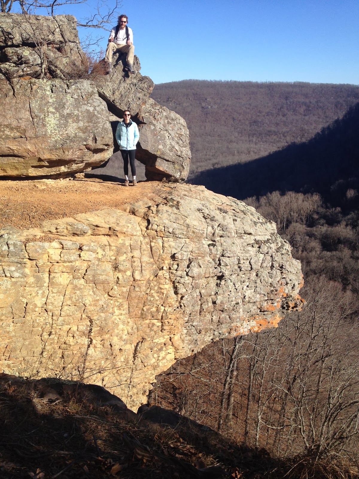
I've always felt a little insecure about considering myself an outdoorsy Arkansan or an expert on trails in Arkansas while having never been to one of the places that helps define The Natural State via book covers, postcards, and frequent appearances in tourist-seeking TV commercials.  I'm speaking, of course, about Hawksbill Crag, aka Whitaker Point, located near Ponca.  This past weekend, I finally remedied that awkward situation by making my pilgrimage.

To get to the trailhead, turn west onto the dirt road at the bridge over the Buffalo on Hwy. 21 (six miles south of Ponca, 10 miles south of Kingston, 1.1 mi. south of the Hwy. 21/ Hwy. 43  intersection).  There are several bridges in the area, so make sure you are at the one that crosses the Buffalo River.  On maps the road is shown as 5 or Cave Mountain Springs Rd., but don't expect to see a sign calling it that at the turn.  I encourage you to use the interactive map below and read multiple online driving directions before making the trip.  The road is fairly well maintained, but it is very steep and clayey, so don't try it shortly after a rain unless you have the right vehicle for the job.

The roughly 3.5 mi. roundtrip trail heads east and downhill from the trailhead/parking area.  After crossing a small stream, the trail eventually levels out.  As you make your way down the trail, the beech (somewhat rare in Arkansas), oak, and hickory forest gives way to pine along the bluff edge.  Be sure to follow the orange triangle blazes as there are several old or unofficial trails in the area.  Along the rim, you'll come across a waterfall and then the main event.  There are a couple great spots to take photos of Hawksbill Crag just up the trail from the rocky outcropping.  Just past the Crag, is a smaller version with a small rock arch on top.  When done taking photos, return back to the trailhead the way you came.  Much of the land in the area is private property and following unlabeled trails could lead to trespassing.  

The Bridge of the Buffalo - Turn here.

Follow these Blazes

First Glimpse of the Crag


Hawk Bill Crag Whitaker Whiteacre Point Pt. Arkansas Buffalo River
About as brave as I got.  It was WINDY!
What I imagine it would have looked like if I had a parachute on my back.


View Hawksbill Crag in a larger map


Wednesday, May 15, 2013

Mulberry River

I recently floated the Mulberry River for the first time.  We went when the river was at 2.7 and true to the descriptions, this was a perfect level for exciting rapids, but slow enough pools to allow for bailing and resting.  We put in a little downstream of Turner Bend and floated about 8 miles to Campbell Cemetery.

Turner Bend, located about 12 miles north of I-40 on Hwy 23, is the best place to get started on a Mulberry River float.  They have maps, supplies, boats, camping, parking, perform shuttles, and are very knowledgeable about current river conditions and float durations.

The photos below are misleading, since the only time I could take photos was while we were in pools.  There were numerous exciting rapids along the route and large waves and drops were common.

Wednesday, March 27, 2013

Lake Leatherwood Eureka Springs

A few weeks ago I visited Eureka Springs for my final boys' weekend prior to entering married life.  We had a great time at The Cathouse Lounge, Mud Street Cafe, The Squid and Whale, and Chelsea's Corner Cafe, but I wanted to do something outdoorsy during the day.

Simply walking around Eureka Springs is great exercise and the beautiful buildings, hilly topography, and springs make it quite scenic, but if you want to get out in the woods a bit, nearby Lake Leatherwood is a good bet.  During warmer parts of the year, you can rent a variety of boats to explore the lake.  In early March, your options are limited to where your own feet can take you.  Luckily, there are lots of trails around the lake and lots of interesting things to see.  The trails range from small, rough, single-track to smooth wide gravel roads.  We hiked parts of the Fuller, Fishing and Beacham trails and our route is shown on the map below.

While Google Maps shows some of the trails, many more can be seen at www.lakeleatherwoodcitypark.com

Thursday, January 17, 2013

Lincoln Lake

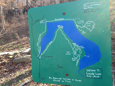
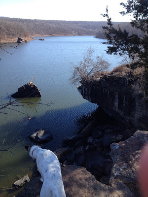
Located in Lincoln, about 20 miles west of Fayetteville, Lincoln Lake is about as good as city parks get for outdoor enthusiasts, with trails for hiking and mountain biking, water for paddling, and widespread scrambling, bouldering, and roped climbing options for rock climbers.  As a novice climber and the only person in the park today, I stuck to hiking and followed the Lake Loop route with a short detour to add on the Lower Eagle Loop.  In addition to interesting rock formations and sheer 30-40' bluffs, the park has a variety of habitat types ranging from scrubby bottomland forest around the incoming streams to drier oak/hickory/cedar complexes on top of the bluffs.

The trails here are very well-marked and work is on-going to improve some sections for biking and easier hiking.  The Lake Loop trail varies from somewhat steep, rocky, and rough  to a flat gravel road.  There are great views all along the trail, but my favorites were from the dam and the Lake View Overlook.

I wrapped up my trip with a local favorite "Burrito Salad" (deep-fried burrito with tomato and lettuce on top) and a Pizza Burger at American Drive-In on the main drag in Lincoln.

I hope to return and cover some other trails and activities at this park, but until then, you can get more information at: http://www.lincolnarkansas.com/?page_id=290


Lincoln Lake, Lincoln Arkansas


Lincoln Lake Map, Lincoln Arkansas

Lincoln Lake, Lincoln Arkansas

Lincoln Lake Climbing, Lincoln Arkansas
Rock Climbing Route #23

Lincoln Lake, Lincoln Arkansas

Creek Crossing

Lincoln Lake, Lincoln Arkansas
My Pinky and Buddy Check Out Lake View Overlook


Lincoln Lake, Lincoln Arkansas


American Drive-in, Lincoln Arkansas


View Lincoln Lake in a larger map

Saturday, November 17, 2012

Mt. Kessler Greenways

For recent news on Mt. Kessler and the Regional Park click here.

With spectacular views, over eight miles of hiking and mountain biking trails, and located just a few miles from the heart of Fayetteville (and campus), Mt. Kessler Greenways is a great place to get out in the woods.  The trails are largely on private land, so be sure to register to use the trails first and stay on the trails when you go.

I went with my friend John and Buddy today to explore some of the trails.  John and I had been before but only did about half a mile due to bad weather.  The map below shows the route we took, which covered 6 miles.  The trail had lots of great views and in one place, marked on the map, the trail runs along a ridge with views off to both sides.

One of the big highlights of the trail is not far from the parking area.  "Rock City", has lots of interesting rock formations reminiscent of parts of Devil's Den State Park (but way closer to Fayetteville).

Efforts are underway to boost awareness of the value of Mt. Kessler and to encourage local governments and the university to help preserve this area as a great recreational and educational resource for the community.  The Mt. Kessler properties border Fayetteville's new regional park, creating the potential for an expanded network of trails and educational facilities.

To find out more visit: http://mtkesslergreenways.com/  or my more detailed post with more photos and mapped trails: http://trailsofarkansas.blogspot.com/2012/12/mt-kessler-revisited.html

(If you got here looking for information on the Nov. 1st Kessler Run, visit here or here.)


Mt. Kessler Fayettevile Arkansas Farmington Mount

Monday, October 15, 2012

Crystal Bridges Museum Trails

Crystal Bridges Art Museum has an impressive network of miles and miles of diverse walking and biking trails that are well connected to the city's trail system and Compton Gardens.  Dogs are allowed on the trails ("but", I was told over the phone, "not in the museum".)  If you take a pet, you might want to look at a map online beforehand, as all of the outdoor map boxes were empty today.  

It has been a year since I last visited the trails (I've been to the museum a few times since then) and I'm glad I finally got to check them all out.  The fall foliage was starting to show up with hickories, red buds, dogwoods, and sassafras providing some amazing yellows, pinks, purples, and oranges that paired beautifully with the pines and still green oaks.  Multiple empty frames placed along the trails make a point I greatly appreciate, that nature provides us with limitless, ever-changing, incredible works of art that are free to everyone.  Each trail has its own unique character and perhaps surprisingly for someone who writes hiking books, my favorite was the very manicured...

Friday, August 10, 2012

Lake Wedington Loop #2

Yesterday I got suckered into my first bike ride of the summer despite my aversion to exercising in non-aquatic environs in August in Arkansas.  My friend and I drove out to Lake Wedington and did the 19-mile loop used in the Ozark Valley Triathlon.  Though it requires driving, this route is much nicer and has less traffic than the ride to the lake from Fayetteville.  As you can see on the terrain map below, the route is fairly flat, but does have a couple significant hills.  While I enjoyed the ride, it left me wishing I'd invested in bike shorts and some cold Gatorade.  After finishing, we cooled off with a swim in the lake.

Saturday, July 21, 2012

Riverside Park - West Fork

Located on 170, a mile east of I-540, this small park has a trail, a playground, pavilions, and nice bluff views.  The 6' concrete loop trail is flat, mostly open, and not quite half a mile long.  An informative kiosk at the trailhead provides information on the town, river, and its watershed.

Some people swim here when the water is deep enough, but I prefer nearby Wreck Hole and others.

Swimming Holes

(Swimming hole list & links at the end.)

Wanting to find a place to cool off with the dog, we went to explore Wreck Hole near the town of West Fork and it was great.  This swimming hole is much closer to Fayetteville than the nicer parts of Beaver Lake and White River and War Eagle put-ins.  The water was cool and there is a nice rock outcropping to climb on.  There was a bit of a litter problem, especially on the gravel bar.

If you visit this or any other swimming hole:  1) Don't bring glass.  2) Plan to carry your trash out (and maybe some trash that isn't yours).  3) Wear shoes as there could be broken glass

Afterwards, we went by the nearby dam in West Fork that is also listed as a swimming hole, but it was completely dry.  There was, however, a nice park there with a walking trail, playground, pavilions, and views of the nice bluffs along the river.


We parked in the gravel pullouts on Campbell Rd. about 0.6 mi. north of 170, but you can also access the area from the local park on the other side, which requires more walking, but offers more space and easier access to the water.

View Wreck Hole in a larger map

Given recent temperatures, here is some information on finding a quality swimming hole near you:

1. Many river access points can make for great swimming holes, especially when rivers are low like they are around the state right now. I enjoy the Siloam Springs Whitewater Park on the Illinois River and Shine Eye on the Buffalo.

2. Beaver Lake, Lake Wedington, Lake Sylvia and many other lakes around the state have swimming areas.

3. Swimmingholes.org has some useful maps and descriptions of many swimming holes around the state. It is where I found out about Wreck Hole.

4. Tim Ernst has a book on Swimming Holes of the Ozarks. I haven't read it, but I'm willing to guess it is informative.

5.  My follow-up piece on Swimming Holes.

6. Here are some of my favorites (click the captions for maps):
Lake Sylvia

Beaver Lake Dam Site

Shine Eye on the Buffalo River
What are your favorite swimming holes? Leave a comment!

*Remember: Conditions such as flow and property ownership change over time. Accuracy of this information and the safety and legality of visiting these places cannot be assured. Each visitor is personally responsible for safety and legality when visiting any site mentioned here or elsewhere on this blog.