For my second leg of the Iron Ranger Challenge, I retraced my footsteps back to a hike along the Buffalo River Trail I first traversed in February of 2013. The trail section from Highway 14 to Maumee offers scenic views and a dynamic terrain, from open vistas of the river to crossing through giant river cane fields. I used Johnnie's previous post on this blog for reminders of the trail. It was a special memory for me because I was in my second year living in Arkansas and was still getting settled in. For my and Johnnie's basically shared birthday, February 1st and 2nd respectively, we celebrated with friends by spending the weekend in Gilbert, Arkansas. We traveled to the Buffalo River for hiking and the list of trail participants went Johnnie, Angela, Justin, Laura, and Michael. All of these people are some of my favorite friends and we had an amazing time exploring the Buffalo River Trail that weekend. I have known Justin and Laura since 2005 and shared lots of good times in college and on the baseball field with Justin. And you know Johnnie, he is cool. Angela is another wonderful friend who is passionate about sustainability. And my main bro Michael Eastham is doing big things in DC, and I will be seeing him soon. They all are amazing people.
This time around I wanted to make sure to hike with friends again and not just solo like my first Iron Ranger trek. I plan to mix it up throughout the Iron Ranger Challenge between solo and shared experiences. Because of springing forward for daylight savings, there were not too many up to the morning hike, but my good friend Nick was willing and eager to join. It was his first time on this part of the Buffalo River Trail and since we didn't have the shuttling option with two cars we chose to do an out and back starting at the Maumee trailhead. This trailhead can be a bit difficult to find and I suggest using the following marker to get directions to this point, whether you are starting here or shuttling from the location.
36°01'22.7"N 92°36'59.5"Whttps://goo.gl/maps/
The hike started out in a heavily wooded area and it took about a mile to get to some waterfall action. I have always found it special to hike after a heavy rainfall because you find falling water where it only happens every once and awhile. Nick and I often stopped to listen to passing water, one of my favorite sounds in the world. Any babbling brook has my attention. When you get to Mile 3 be on the lookout for a river crossing. No matter what time of year, you will be wading through water. Just to note, if your shoes get wet, you can use them again. At around Mile 3.9 you are treated to one of the best of vistas of the Buffalo River (see picture 3 below). After we took a break here, we continued to mile 5.5 where there is clear marker (see picture 5) and is when we chose to turn around. The weather could not have been better for an early spring hike and I was so happy to be outside for trek on the Iron Ranger Challenge.
Sharing the trails with my friends makes me smile inside and out. Johnnie and I also had a chance to hike this past weekend along the infamous pacific coast and we look forward to sharing that experience with you soon!
I'll be back on the Buffalo River Trail later this month. Let me know any of your favorite sections, I may just check them out and am always open to suggestions. Happy trails to you, until we meet again!
*All pictures below taken by my friend Nick*
1. Waterfall
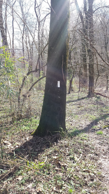
2. Be on the Lookout for White Blazes
3. Buffalo River Vista
4. Trail Marker
5. Friendly PSA: Gilbert is the Coolest Town in Arkansas
6. JK3, Mark Eastham - future Iron Ranger Trek friend, Nick (from left to right)


No comments:
Post a Comment