Thursday, February 14, 2013

Healthy Campuses

This is a little off topic from my usual posts, but it is something I've spent some time thinking about and wanted to write about here before reworking it for a letter to the editor or a guest-post somewhere.

I've been a student at three different universities now.  One on each coast and now at the University of Arkansas.  To some extent, all of these schools encourage their students to eat healthy and exercise in order to take care of their mental and physical well-being.  Of the three, the University of Arkansas, in my opinion, does the poorest job providing the facilities and infrastructure necessary to encourage students to be active.

Here are a few examples I've noticed of how UA lags behind UC Berkeley and Duke in terms promoting exercise and fitness.

1.  I will start with one that relates directly to this blog; trails.  UC Berkeley borders large greenspaces that have mile after mile of wide, dirt trails (firetrails).  Duke has a massive 7,000 acre forest with miles of hiking and biking trails.  The flagship university of the Natural State has neither, though the nearby, paved, Razorback Greenway is nice.  UCA and the University of the Ozarks have more walking and mountain biking trails than UA.

2.  UC Berkeley and Duke allowed students and the public to run on their tracks.  Heck, my dorm at Berkeley had a track with an incredible view of the bay, where you could run in the shade of towering eucalyptus while getting lost in the scenery.  Arkansas prohibits students from running on their outdoor track, though students can use a tiny, musty 200m indoor track with views of basketball courts below.

3.  UC Berkeley and Duke have outdoor pools.  UA doesn't.  Berkeley actually had 3 or 4 outdoor pools that students could use.  While you could argue the Bay Area's climate allows for more efficient use of outdoor pools, the weather at Duke is fairly similar to what we have in Arkansas.  I took a class at Indiana University and even they had an outdoor pool.  A public university, in INDIANA.  And they let the public use it, not just students.

4.  Berkeley is not a car-friendly campus and neither is the surrounding city.  When I lived there, it was faster and easier to bike anywhere within 4-miles than it was to drive.  Both Duke and Arkansas have enormous parking lots, garages, and roads throughout campus, which promote driving and detract from the campus experience (and aesthetics).  Arkansas has a long way to go before it can be considered a bike-friendly campus and current powers-that-be incorrectly assume bike infrastructure on campus is more than adequate.

I'm not sure what all contributes to this problem at UA, but one likely cause is the heightened level of deference given to the athletics teams.  What other reason could there be to not allow students to use the outdoor track, which is deserted most hours of most days of the year.  It is interesting to note that Duke and UC Berkeley are big sports schools too, but still allow students to use these facilities. It would be a shame if UA's efforts (and 100's of millions of dollars) to build a stronger sports program were negatively impacting the health of its student body.  Even if private money covered the construction costs of all the athletic facilities, I believe it is still state dollars and student tuition and fees that cover the utilities for these massive buildings that lie vacant much of the year. Why not let us use what we are helping pay for?

UA Outdoor Track

UC Berkeley Outdoor Track #2

Duke Forest Fun


Tuesday, February 5, 2013

Buffalo River - Gilbert Railroad Trail

The Old Railroad Trail in Gilbert, is a great hike to do with kids.  At less than 4 miles in-and-out, this mostly flat trail has interesting rock walls, views of the Buffalo River, and large remnants of its not-too-distant railroad past.  I usually get my kicks by checking out the cacti and other amazing plants along this trail and skipping rocks at the river, but when I went with friends in Feb. 2013, we were directed by a friendly gentleman on horseback to a bobcat hiding in a tight crevice in one of the rock walls!

Crinoids!!! (right?)

Unhappy Bobcat

If anyone ever climbs to the top they will find the rocks we threw


View Railroad Trail - Gilbert, AR in a larger map


Buffalo River Trail - Hwy 14 to Maumee South

For my birthday, a group of friends and I went to Gilbert for the weekend and did a couple hikes.  After warming up on the Old Railroad Trail at Gilbert, we tackled the ~12 mile section of the Buffalo River Trail  between the Hwy. 14 bridge and Maumee.  We left one car at Maumee, at the difficult to spot trailhead and parking area located about 1.7 mi. past the end of the paved road and 1.8 mi. before you reach the put-in.  From there we drove to the Hwy. 14 bridge and walked southwest under the bridge and along the road before getting on the Buffalo River Trail (#1 on map).

For this blog entry, I've included more information on the map than usual.  Let me know in the comments if this is useful or if it makes the map too busy.   Shortly after leaving the road, the trail heads uphill for the toughest climb of the entire section, with an elevation gain of ~500 feet.  Once you are on top of the bluffs, take in the amazing views of the Buffalo River Valley (#2 and #3) before heading back downhill and crossing a (possibly dry) stream bed.  The trail follows an old dirt road between miles 4 and 5 and at a couple other locations along the trail.  Be sure to keep an eye out for where the trail splits off of again (#6).  Near the 8-mile mark there is another great view (#7) right before another downhill section followed by a steep climb.  Just after the 10 mile mark, there is a small man-made pond.  From there the trail follows a contour around a small valley and then heads uphill to the road and trailhead marked with a small pile of rocks.


Beginning of hike near Hwy. 14 Bridge

Halfway Point on Road to Spring Creek


Giant River Cane in the Bottoms


We had one cold wet crossing

Trailhead on road to Maumee


Thursday, January 17, 2013

Lincoln Lake

Located in Lincoln, about 20 miles west of Fayetteville, Lincoln Lake is about as good as city parks get for outdoor enthusiasts, with trails for hiking and mountain biking, water for paddling, and widespread scrambling, bouldering, and roped climbing options for rock climbers.  As a novice climber and the only person in the park today, I stuck to hiking and followed the Lake Loop route with a short detour to add on the Lower Eagle Loop.  In addition to interesting rock formations and sheer 30-40' bluffs, the park has a variety of habitat types ranging from scrubby bottomland forest around the incoming streams to drier oak/hickory/cedar complexes on top of the bluffs.

The trails here are very well-marked and work is on-going to improve some sections for biking and easier hiking.  The Lake Loop trail varies from somewhat steep, rocky, and rough  to a flat gravel road.  There are great views all along the trail, but my favorites were from the dam and the Lake View Overlook.

I wrapped up my trip with a local favorite "Burrito Salad" (deep-fried burrito with tomato and lettuce on top) and a Pizza Burger at American Drive-In on the main drag in Lincoln.

I hope to return and cover some other trails and activities at this park, but until then, you can get more information at: http://www.lincolnarkansas.com/?page_id=290


Lincoln Lake, Lincoln Arkansas


Lincoln Lake Map, Lincoln Arkansas

Lincoln Lake, Lincoln Arkansas

Lincoln Lake Climbing, Lincoln Arkansas
Rock Climbing Route #23

Lincoln Lake, Lincoln Arkansas

Creek Crossing

Lincoln Lake, Lincoln Arkansas
My Pinky and Buddy Check Out Lake View Overlook


Lincoln Lake, Lincoln Arkansas


American Drive-in, Lincoln Arkansas


View Lincoln Lake in a larger map

Friday, January 4, 2013

Pear Lake Ski Hut Snowshoe

A friend and I started out 2013 with a trip to Sequoia/Kings Canyon National Park to snowshoe up to the Pear Lake Ski Hut (followed by a few days at Joshua Tree National Park).  To get somewhat acclimated, we spent a night at Wuksachi Lodge (7,000') and tested our gear with a short snowshoe around the Giant Forest sequoia grove.  After seeing the awe-inspiring General Sherman, The President, Chief Sequoyah, and The Senate trees via some combination of summer, winter, and off-trail routes we drove back to the lodge for a great meal and some sleep.

We took advantage of the satisfying (and warm) breakfast buffet at Wuksachi before packing our backpacks, driving the short distance to Lodgepole to drop off our backcountry permit, and finally driving a few more minutes to the Pear Lake Trailhead at Wolverton.  While putting on our packs and snowshoes, we questioned our choice of winter activities while listening to shouts of joy and laughter coming from the nearby snow-play area where people were sledding.

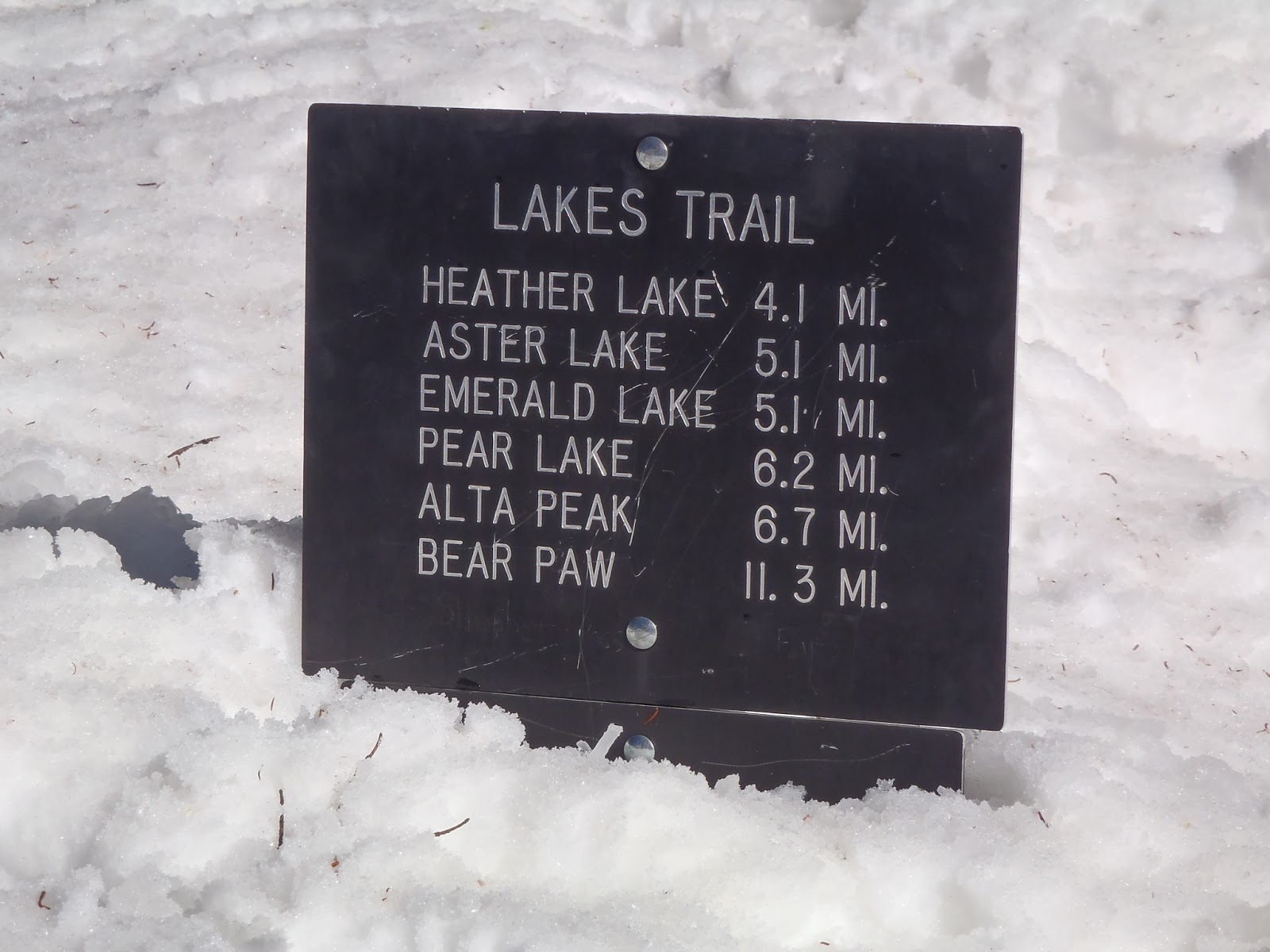
As you can see on the map and elevation graph below, the trek up to Pear Lake is 5-6 miles and involves lots of elevation change.  While our route was just over 5 miles, the summer route is less direct, has more switchbacks, and goes a bit past the hut to the campsites at the lake.

The first mile and a half or so were not bad as we worked our way gradually uphill through a fairly dense forested area.  At the Panther Trail junction, the route to Pear Lake veers off  to the left and heads straight up a long, steep slope nicknamed "The Hump".  The next two miles were pretty brutal on our calves (and egos) as we gained about 1,700 ft. in elevation with very little help from any switchbacks.  The Hump tops out (after several false summits) at 9,400 ft. and offers some great views while you catch your breath.

From there the trail shot down a steep slope to Heather Lake, which was frozen over.  After opting to snowshoe around the lake rather than across it as tracks showed us some people had obviously done, we worked our way up a short, steep incline.  From there we went another 0.75 mi. which included another steep downhill section followed by a gradual uphill trudge before deciding to take a break.  At this point we thought we had another mile to go based on what maps and route descriptions had told us, but based on what I'd seen in aerial images of the place, I suspected we might be closer.  After our break we walked a hilariously short minute or so before seeing the hut which had been hiding right around the corner.

Most people visit the hut in order to ski or snowboard on the nearby slopes.  Having only snowshoes, we did a quick dayhike up to Pear Lake, before retiring to the hut for an evening full of conversation and food.

We covered the ~5 miles in at just over 1 mph and the same route out at about 2 mph.  Speeds will vary greatly depending on trail conditions, presence of packed snow or fresh powder, personal fitness etc, so be sure to start early and give yourself as much daylight as possible to get there and be prepared to camp on the snow or head back to your car if you aren't making rapid enough progress.  We benefited from a well worn path and clear, sunny weather.  Under less ideal conditions it could have easily taken us 10 hours to get there.

Pear Lake Ski Backpack Snowshoe Sequoia National Park
Getting Ready


Pear Lake Ski Backpack Snowshoe Sequoia National Park
Steep Slopes, Few Switchbacks

Pear Lake Ski Backpack Snowshoe Sequoia National Park
Shortcuts Across Frozen Lakes

Pear Lake Ski Backpack Snowshoe Sequoia National Park
Getting Close

Pear Lake Ski Backpack Snowshoe Sequoia National Park
The Hut

Pear Lake Ski Backpack Snowshoe Sequoia National Park
Ski Hut in Winter, Ranger Station in Summer

Pear Lake Ski Backpack Snowshoe Sequoia National Park
Dayhike to Frozen Pear Lake

Getting Water

Pear Lake Ski Backpack Snowshoe Sequoia National Park


All Done


View Pear Lake Ski Hut Snowshoe in a larger map


California Readers: Interested in getting paid to unplug your laptop or turn off a light for an hour? $20 just for joining OhmConnect, learn more at: https://login.ohmconnect.com/ref/30315