We took advantage of the recent chilly weather and camped at Steel Creek Campground on the Buffalo National River. Steel Creek has some amazing bluffs and is a nice place for some exciting paddling when the water is up. This particular weekend, it wasn't, so we went for a hike along the Buffalo River Trail. The section between Steel Creek and Ponca is a short 2 miles, but does have a healthy amount of elevation change. With the leaves still on the trees, the views here were good but not incredible. At Ponca, we explored the old James Villines homestead, relaxed by the water, and then walked back to Steel Creek via the trail. If you didn't like the trail, or would like to make a loop instead, you can take the road back, but it is a bit windy and sometimes people don't obey the speed limit!
On our way home, we ate at the Low Gap Cafe and I recommend it to anyone visiting the area. On Sundays they have live music and a buffet. The band we heard played Spanish, Brazilian, American folk, and other unexpected genres of music. I'm told they have music other days as well.
If this is your first visit, I encourage you to navigate using the tabs at the top of the page or the labels down the left side. You can also visit the "Using This Site" page.
Monday, October 21, 2013
5 Largest State Parks in Arkansas
Here are the five largest state parks in Arkansas. Which have you been to? What were your favorite trails?
Note: These rankings are impacted by whether water area is included. Many parks border or contain large lakes and whether the area of the lake should be included in comparisons of this type is a bit of a grey area.
Note: These rankings are impacted by whether water area is included. Many parks border or contain large lakes and whether the area of the lake should be included in comparisons of this type is a bit of a grey area.
1. Hobbs - 12,056 acres. Hobbs State Park-Conservation Area is located on the south shore of Beaver Lake in Northwest Arkansas. It is the largest state park, but is co-managed by Arkansas State Parks, Arkansas Natural Heritage Commission, and the Arkansas Game and Fish Commission. The park has a large visitor center and many miles of hiking and biking trails.
Thursday, October 17, 2013
Everglades - National Park of the Week #5
Everglades National Park
Location: Southern tip of FL. West of Miami, SE of Naples.
Area: 1,508,538 acres
Major Attractions: Huge wetlands, prairie marls, mangrove swamps, unique wildlife.
Miles of Trail: 150+ (Land and Water)
My Favorite Parts: Seas of grass. Alligators! Campsites on platforms in the water.
Getting There: Drive west on US-41 from Miami or east on US-41 from Naples. You can't miss it!
Website: http://www.nps.gov/ever/index.htm
With an average elevation just above sea-level, put this park on your to-see-soon list. Like Glacier National Park, its main attractions could disappear in our lifetimes due to climate change. Everglades National Park is the tenth largest national park in the United States. Most of the park is inaccessible except by boat or fanboat, but the views from the roads and few trails are pretty spectacular. Waterfowl are everywhere and alligators often sun on warm paved surfaces. The canoe trails along the coast that lead to camping platforms in the middle of the water are some of the most unique trails in the country (the platforms provide for relatively mosquito, snake, and alligator free camping). Expensive efforts are underway to restore the Everglades, while invasive pythons, agricultural runoff, and rising sea-levels threaten to destroy the park at least as we know it today. Next time you visit The Keys or Miami, spend a day exploring this amazing park before it is too late!
Location: Southern tip of FL. West of Miami, SE of Naples.
Area: 1,508,538 acres
Major Attractions: Huge wetlands, prairie marls, mangrove swamps, unique wildlife.
Miles of Trail: 150+ (Land and Water)
My Favorite Parts: Seas of grass. Alligators! Campsites on platforms in the water.
Website: http://www.nps.gov/ever/index.htm
With an average elevation just above sea-level, put this park on your to-see-soon list. Like Glacier National Park, its main attractions could disappear in our lifetimes due to climate change. Everglades National Park is the tenth largest national park in the United States. Most of the park is inaccessible except by boat or fanboat, but the views from the roads and few trails are pretty spectacular. Waterfowl are everywhere and alligators often sun on warm paved surfaces. The canoe trails along the coast that lead to camping platforms in the middle of the water are some of the most unique trails in the country (the platforms provide for relatively mosquito, snake, and alligator free camping). Expensive efforts are underway to restore the Everglades, while invasive pythons, agricultural runoff, and rising sea-levels threaten to destroy the park at least as we know it today. Next time you visit The Keys or Miami, spend a day exploring this amazing park before it is too late!
 |
| Pelicans, Everglades National Park |
 |
| Trail at Shark Valley, Everglades National Park |
Wednesday, October 16, 2013
Mount Magazine - State Park of the Week #5
Mount Magazine State Park
Location: Western Arkansas. 100 mi. S. of Fayetteville. 100 mi. W of Little Rock.
Area: 2,234 ac.
Major Attractions: Highest Point in Arkansas (2,753 ft). Great Views. Nice Lodge.
Miles of Trail: 20+ Some longer trails leave the park.
My Favorite Part: Easy trails with nice views. Eating at the lodge after a cold night of camping.
Getting There:
From Little Rock: Take Hwy-10 west and then turn right on AR-309. This route is much more scenic than taking the interstate and doesn't take much longer.
From the website:
Mount Magazine State Park is located on Scenic Highway 309 approximately 16 miles south of Paris; or from Danville, travel nine miles west on Ark. 10 to Havana, then go 10 miles north on Scenic Highway 309.
Website: http://www.mountmagazinestatepark.com
Mount Magazine State Park contains the highest point in Arkansas and offers stunning views of the Arkansas River Valley and the Ouachita Mountains. The top of the mountain is somewhat flat and mostly forested, so the best views are found around the rim rather than at the peak. The lodge, cabins, and campsites are very popular in the fall, so be sure to book in advance. There is a network of short trails that take you to various points around the mountain and these connect to longer trails that leave the park.
Tuesday, October 8, 2013
Bryant Trail - Fayetteville
I wasn't expecting much from this trail after spotting it on Fayetteville's GIS map since the map showed a loop trail winding through a complex of county buildings and a jail in an industrial part of town. At a bit over a mile, this trail was full of surprises, most pleasant. Not every trail can claim to pass a jail AND a shooting range. In fact, a section of the trail is closed when the range is active. Besides those landmarks, the trail runs through open grassy areas with some shade trees. As you can see on the map below, the trail overlaps a road for a short distance. This isn't well labeled, so just follow the road until you find the trail again.
Parking for the trail is located off Clydesdale Dr. off of School Ave. in southern Fayetteville.
Parking for the trail is located off Clydesdale Dr. off of School Ave. in southern Fayetteville.
Saturday, October 5, 2013
The Southwest Trail
Plans are being developed for a trail between Little Rock and Hot Springs. This 50-mile trail would follow the old Rock Island Railroad track and would be one of the longest Rails-to-Trails projects in the country. One of the great things about using old railroad beds is that much of the earth-moving and grading work is already done and you are guaranteed a trail with no steep slopes (which is no easy task when passing through the Ouachitas).
Many local officials from counties and cities along the path have expressed interest, so now the big question is where the ~$20 million will come from. Funds for these types of projects often come from a variety of sources including federal transportation dollars, as well as state, county, and city funds. Arkansas gets roughly $10 million a year in federal Transportation Alternatives funds, but these don't go just to trails. It should be noted that funds for trails via this program and from more local sources are under constant threat these days by political parties and groups that think all transportation dollars should go towards expanding highways and repaving roads as part of an unbalanced "cars only" approach to transportation policy. If we want more funding for trails, we need to encourage our lawmakers to protect existing funding sources and pass local initiatives similar to the statewide 1/8th cent conservation sales tax and the sales tax increase that Little Rock recently passed in part to fund parks and trails.
This trail would help complete the second side of the "city-in-a-park" trail triangle that is part of the Little Rock Parks Master Plan.
The Prezi below, by Mason Ellis, has more details on the project.
Friday, October 4, 2013
River Trail Updates
On a recent trip to the bridge at Two Rivers Park, I noticed the large scale sculpture/model of the Arkansas River showing major points of interest along the trail. The concept of the River Trail has recently been extended to Pinnacle Mountain State Park on the south side of the river and to Palarm Park on the north. In fact, plans are in place for a "Grand Loop" (shown below) that would reach Conway. Much of the existing River Trail and the Grand Loop follow roads. As long as the speed limits on these roads are 20-25 mph, that is pretty safe, but hopefully a separate trail will be built for the stretches on larger roads with faster moving traffic.
Key Points:
The original map and up-to-date info can be found at: http://arkansasrivertrail.org/maps/
Key Points:
- The trail follows Crystal Hill Rd. in Maumelle for a while. This allows it to be closer to the river and gets bikers off of busy, fast moving, Maumelle Blvd.
- It looks like they are making a real trail along the edge of parts of Maumelle Blvd.
- Maumelle has a great network of existing trails that will either form part of the River Trail or make for interesting, scenic detours. This will also make it easier and safer for residents of Maumelle to commute by bike to work in North Little Rock and Little Rock.
- On the south side, the trail extends to Two Rivers Park via the new bridge, and then to Maumelle Park. I believe the separate trail ends there and the River Trail follows Pinnacle Valley Rd., AR-300, AR-113, AR-60, and AR-89 for most of the Grand Loop.
The original map and up-to-date info can be found at: http://arkansasrivertrail.org/maps/
View River Trail Expanded in a larger map
Wednesday, October 2, 2013
Coleman Creek Greenway UPDATE
A new stretch of the Coleman Creek Greenway will open soon on the UALR campus. The new section, running between 28th and 20th St. will double the length of the existing trail and increase the trail's connection to the community. This new section travels through a forested part of campus and should feel a bit more natural than the southern half which closely parallels roads and parking lots for much of its length. One day, this trail may run from Markham, south through War Memorial Park, through UALR, and down to Fourche Creek, where it will hopefully connect to other trails following Rock Creek and Fourche Creek coming in from Hindman Park, Boyle Park, and Fourche Bottoms.
Yosemite - National Park of the Week #4
Yosemite celebrated its 123rd birthday this week and is one of my favorite parks, so it was the natural choice for this week's NPOTW.
Yosemite National Park
Location: Eastern CA. 190 mi. E of San Francisco, 100 mi. N of Fresno
Area: 748,000 acres
Major Attractions: Massive granite domes, scenic glacier-carved valleys, stunning waterfalls, sequoia groves
Miles of Trail: 750+
My Favorite Parts: High Sierra Lakes, Backcountry Vistas, Granite Domes
Getting There: From Fresno: 2 hours - Drive north on CA-41
From Bay Area: 3 hours - I-580 E, I-205 E, I-5 N (short!), CA-120 E
Website: www.nps.gov/yose/
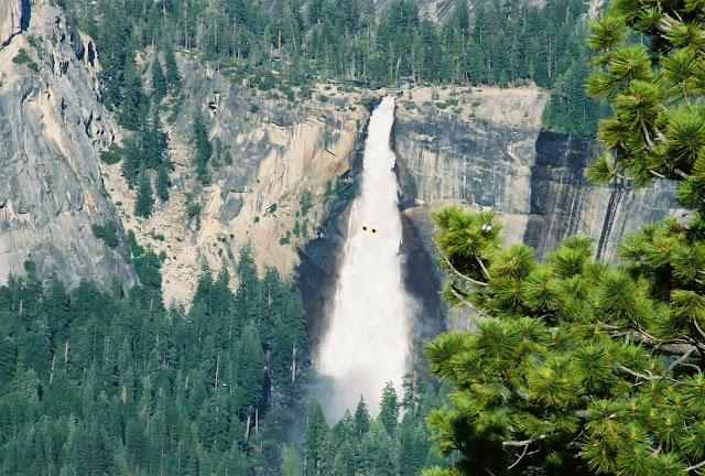
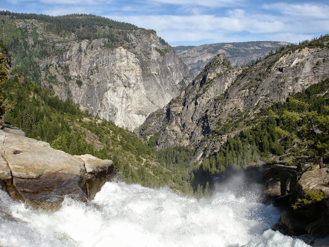
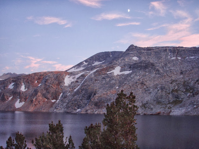
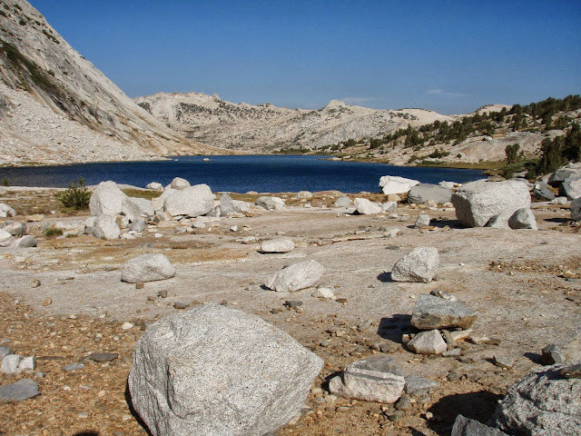
Established as the third National Park in the country, Yosemite is one of our country's most iconic parks. Its jaw-dropping glacier-carved valleys with their incredible waterfalls and huge exposed granite faces and domes are hard to beat in terms of sheer scenic beauty. Besides the summer traffic, my main complaint about the park used to be its lack of wildlife, however, after my last trip there I can no longer make that complaint. The most famous views in the park are in Yosemite Valley and from Glacier Point. I think Hetch Hetchy Valley and views of Mono Lake from the eastern edge of the park are just as spectacular. If you hate crowds and traffic, Yosemite has an enormous backcountry/wilderness area. With the exception of the hike to and up Half Dome, my general rule of "once you hike two miles into the wilderness the crowds disappear" holds true. For this reason the backcountry is my favorite part of the park. Views often look better when you have to work for them (and when there are no crowds of strangers in the way); and for that reason I find the views around Ten Lakes, Parker Pass, Cathedral Peak, and Clouds Rest to be some of the best in the park.
Yosemite is beautiful year-round, but late spring is probably the best time to visit to see the waterfalls in their full glory. If you are looking to backpack and want to avoid crowds, high temperatures, and walking on snow, the fall is probably ideal.
My other piece on Yosemite can be found at:
http://trailsofarkansas.blogspot.com/2013/06/hetch-hetchy-yosemite-national-park.html
California Readers: Interested in getting paid to unplug your laptop or turn off a light for an hour? $20 just for joining OhmConnect, learn more at: https://login.ohmconnect.com/ref/30315
Yosemite National Park
Location: Eastern CA. 190 mi. E of San Francisco, 100 mi. N of Fresno
Area: 748,000 acres
Major Attractions: Massive granite domes, scenic glacier-carved valleys, stunning waterfalls, sequoia groves
Miles of Trail: 750+
My Favorite Parts: High Sierra Lakes, Backcountry Vistas, Granite Domes
From Bay Area: 3 hours - I-580 E, I-205 E, I-5 N (short!), CA-120 E
Website: www.nps.gov/yose/
Established as the third National Park in the country, Yosemite is one of our country's most iconic parks. Its jaw-dropping glacier-carved valleys with their incredible waterfalls and huge exposed granite faces and domes are hard to beat in terms of sheer scenic beauty. Besides the summer traffic, my main complaint about the park used to be its lack of wildlife, however, after my last trip there I can no longer make that complaint. The most famous views in the park are in Yosemite Valley and from Glacier Point. I think Hetch Hetchy Valley and views of Mono Lake from the eastern edge of the park are just as spectacular. If you hate crowds and traffic, Yosemite has an enormous backcountry/wilderness area. With the exception of the hike to and up Half Dome, my general rule of "once you hike two miles into the wilderness the crowds disappear" holds true. For this reason the backcountry is my favorite part of the park. Views often look better when you have to work for them (and when there are no crowds of strangers in the way); and for that reason I find the views around Ten Lakes, Parker Pass, Cathedral Peak, and Clouds Rest to be some of the best in the park.
Yosemite is beautiful year-round, but late spring is probably the best time to visit to see the waterfalls in their full glory. If you are looking to backpack and want to avoid crowds, high temperatures, and walking on snow, the fall is probably ideal.
My other piece on Yosemite can be found at:
http://trailsofarkansas.blogspot.com/2013/06/hetch-hetchy-yosemite-national-park.html
 |
| Near Ten Lakes |
 |
| Near Ten Lakes |
 |
| Dome Near Cathedral Peak, Yosemite National Park, California |
 |
| View Near Medlicot Dome |
 |
| Waterfall - Yosemite |
 |
| Cathedral Peak |
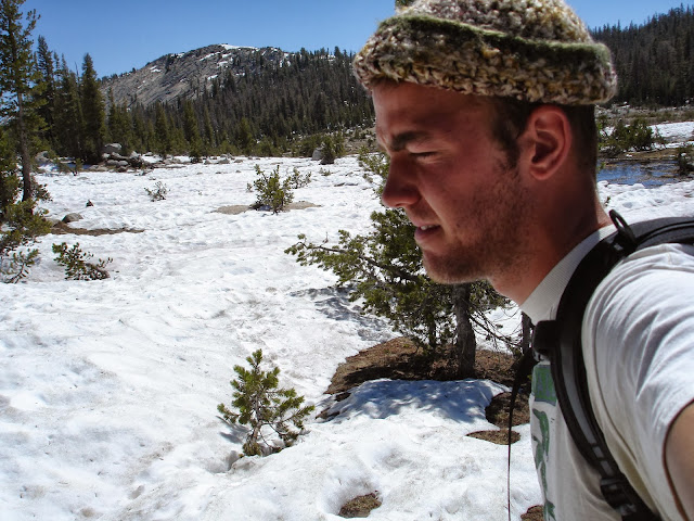 |
| Unhappy about Backpacking on Snow |
 |
| Glacier Point |
 |
| Hetch Hetchy Valley |
 |
| Trail to Ireland Lake, Yosemite |
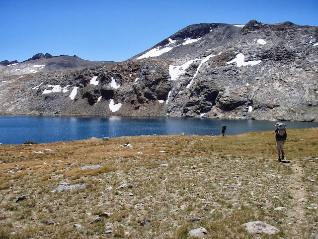 |
| Ireland Lake |
 |
| Looking Towards Townsley Lake and Vogelsang from ridge near Ireland Lake |
California Readers: Interested in getting paid to unplug your laptop or turn off a light for an hour? $20 just for joining OhmConnect, learn more at: https://login.ohmconnect.com/ref/30315
Subscribe to:
Comments (Atom)


.jpeg)


