Some friends and I wanted to get in some backpacking practice nearby before taking a larger trip this summer and decided to do the short, 5.6 mile stretch between Tyler Bend and Gilbert. We parked at the Collier Homestead trailhead and backpacked east through some nice open woods that still showed signs of a recent controlled burn. The trail parallels the road into Tyler Bend for nearly two miles before reaching the Hwy. 65 bridge. The trail then crosses the bridge, passes under it, and continues east along the north side of the river.
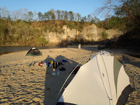
Where the trail crosses the gravel road, we took a detour down the road to camp on the gravel bar at Shine Eye. We had the place to ourselves and the river, bluffs, and night-sky were amazing.
The next day, we walked back up the road and continued along the trail. Just north of the gravel road is a steep uphill section that took us to the top of the bluff and around a major bend in the river. After a while, we came upon the remains of what must have been a nice house with an amazing view.
A short distance from the house, there is a fork in the trail. If it has rained hard recently, you might want to turn left and head down to Hwy 333 to get into Gilbert to avoid both a long, very muddy section of trail and crossing (Very Far From) Dry Creek. Otherwise continue straight and head down into the flood terrace. The dense river cane and other vegetation give his section a jungle-like feel.
For the final leg of our backpacking trip we waded across Dry Creek, hiked a short distance along the Buffalo, and into Gilbert. After eating, we floated from Tyler Bend to Gilbert. Since the river was at 9.5 feet and really moving, I don't have any photos of that much-shorter-than-usual trip. Including a brisk, brief intentional dip in the river, the float probably took an hour. In case you are reading this to plan a float, 2.5-4 hours is more typical for a relaxing paddle along this scenic stretch of the river.
For info on other hikes and floats along the Buffalo, click here and scroll down.
 |
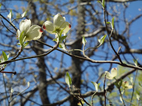
| Dogwoods in Bloom (3/24/12) |
 |
| Shine Eye Gravel Bar |
 |
| Drying Off After Crossing "Dry" Creek |
View BRT in a larger map
Just for clarification for future hikers.
ReplyDeleteThe BRT no longer crosses the 65 highway bridge, instead it goes under it and stays on the south side of the river and continues to hwy 14 (Dillards Ferry). The trail from 65 hwy to Gilbert is still there but is now considered a separate trail.