Pages

Monday, September 22, 2014

Refueling on the Razorback Greenway

As longer and longer trips on the Razorback Greenway become possible, more and more people will be looking for places to take a pit stop or refuel.  Starting in Fayetteville and ending in Bella Vista, this is a list of places within a couple blocks of the trail where you can get cold drinks, snacks, or use the facilities.  The numbers provided are rough distances from where the trail hits 15th St. at the southern end of Walker Park.  The map at the very end comes from NWATrails.org and shows parking, water fountains, and more.


Fayetteville - 15th and Walker Park

0.0 Bathroom in the SE corner of the park near the basketball goals.
0.5  Korean Market less than a block north of the trail on School. Cold drinks near the front door and lots of interesting snacks, produce, and food options.
0.6 Just past School, the Tsa La Gi Trail splits off from the Greenway and provides access to a gas station and many fast food places and restaurants.

Fayetteville - MLK to Dickson
0.9 Wood Stone Pizza and Greenhouse Grille are great local places for good food and drinks. There is a Walgreens across School.
1.1 The Fayetteville Public Library is just to the east up a steep, short spur trail. It has a cafe and restrooms.
1.2 Once you hit Center, Geraldi's is a block to the west on University.
1.3 Wine Cellar, Rolando's, and a chicken place are right on the trail. Grubs is across the street.
1.4 Dickson Street! There are dozens of restaurants and bars here. Arsaga's and Deluxe Burger are right on the trail.


To Be Continued...
Contact me if I'm missing a place or if you want your business featured.


Sunday, September 7, 2014

Jemison Park Nature Trail - Birmingham, AL

The Jemison Park Nature Trail in Mountain Brook runs along Shades Creek and Watkins Creek about a mile east of the Birmingham Zoo and wonderful Botanical Gardens.  This scenic 2+ mile trail is well-used by joggers, people with dogs, and walkers.  Much of the trail is paved, but the two ends of the trail are unpaved and there are several dirt spurs that go closer to the creek.


Little Rock Audubon Center Wildlife Observation Trail - Audubon Arkansas

Located on land that was formerly Gillam Park and public housing, the 400+ ac. Little Rock Audubon Center encompasses several different habitat types including bottomland hardwood forest, cypress-lined oxbow, upland white oak/hickory, post oak savannah, and ultra-rare nepheline syenite glades.

My book, Trails of Central Arkansas, contains maps of the older trails around the center, but it doesn't have the newest trails that were recently completed.  These trails loop around through the post oak savannah on the hillside behind the nature center building.  Some of the trails are "Barrier Free", while others are paved but too steep to meet the definition.

The trails have educational signage and great views of downtown Little Rock and the airport runways.  The best way to access them is to park at the Audubon Arkansas office on Springer Blvd.

Hopefully this trail will soon head west through the unique glades and down to the trails around the oxbow and the rest of the center.

More information can be found at: http://ar.audubon.org/
To learn more about how the nature center property could one day be part of a much larger public greenspace full of trails and floating opportunities, read my post on Fourche Bottoms Park.


Friday, August 15, 2014

Arkansas' Other Trails: Trail of Tears

After covering beer and wine trails, it is time to discuss a much older trail with a tragic history; the Trail of Tears.  The Trail of Tears refers to the routes taken during the forced relocation of Native Americans from some southeastern states to Oklahoma.  Tens of thousands were forced from their homes and many didn't survive the trip west.  As you can see on the map below, several routes passed through Arkansas.

Some sections of the Trail of Tears are preserved as trails today in places like Village Creek State Park and the Trail of Tears park at UALR (which is part of the Coleman Creek Greenway).  The Tsa La Gi trail in Fayetteville follows the approximate route of the trail as well.  The Fort Smith National Historic site was part of the water route and has exhibits and information on the routes.  Visiting any of these locations is a great way to learn some history while you walk, hike, or bike.  The Trail also has lots of potential to be expanded and doing so would benefit the public in multiple ways.     

I'm sure I'm missing some other sections as well, so let me know about it in the comments below.


Tsa La Gi Trail in Fayetteville

Tuesday, August 12, 2014

Arkansas' Roads: Dangerous By Design. We Can Do Better.

Bicyclist and pedestrian fatalities are on the rise in Arkansas and the United States as a whole.  We can and must do better.  Better street design, wider sidewalk, more protected bike lanes or separate trails, and lower speed limits in areas with heavy pedestrian and bicycle traffic would help immensely. 

The following information was taken largely from Smart Growth America's Dangerous by Design report.  It has detailed information on pedestrian fatalities nationwide and provides policy recommendations for addressing this horrible problem.  Please read on or visit their pages to learn more about the issue and what you can do to help.

Smart Growth America - Dangerous by Design: Arkansas Report
Smart Growth America - Dangerous by Design: Fatalities Map
League of American Bicyclists Report via Bicycling.com

Here are some key quotes from the report:

"Between 2003 and 2012, 403 people were killed while walking in Arkansas, representing 6.5% of the 6,181 traffic-related fatalities in the state during this period."  (nearly 10% for the Little Rock MSA)
"Arkansas’s overall Pedestrian Danger Index (PDI) is 79.98, which places it 14th nationally."
"40.6% of these people were killed on arterial roads, which are eligible to receive federal funding for construction or improvement, with federal design guidance or oversight."
"Over that decade, 73.4% of pedestrian deaths occurred on roadways with a speed limit of 40 mph or higher. 3.3% were on streets with a posted speed limit under 30 mph and just 0.8% of pedestrians died on streets with a speed limit of 20 mph or lower."
Speed limits have a major impact on fatality rates in bike accidents as well and Americans are 3-5 times more likely to die while biking than their Western European counterparts.  This is largely due to speed limits on roads that bikes share with cars and with the lack of protected/separate bike lanes in the United States.
Here are screenshots of the fatalities map for Northwest Arkansas and Central Arkansas:

Tuesday, August 5, 2014

Arkansas' Other Trails: Altus Wine Trail

In a fitting follow-up to my piece on the Ale Trail, I will cover Arkansas' wine trail.  Depending who you ask, the wine trail just includes 4 wineries around Altus or pretty much any winery in the state.  I tend to disagree with the growing trend of just connecting every business in a certain category in Arkansas and calling it a trail (a 600 mile Cheese Dip Trail, really?), so I will focus on the Altus route.

The Altus Wine Trail is about 4.3 miles one-way and would be a somewhat hilly bike ride.  If Altus or the wineries got serious about promoting this trail, it looks like you could make it a more scenic walk/mountain bike by connecting Chateau Aux Arc to the dirt road just to the west that loops down to Wiederkehr (see map below). From there it is just about a mile and a half to Post and nearby Mount Bethel. You might even be able to find an alternate route down the hill to avoid 186, but I have no idea what the property boundaries look like there.

I'm not a wine expert, so if you have strong feelings about any of the wineries below let me know in the comments!

Chateau Aux Arc - This is one of the newer wineries and in my opinion it has the best landscaping and
nicest grounds.  If you are a fan of having picnics at wineries, this would be my choice.  I've only been twice and the first time they didn't have many wines to choose from, saying the grapes struggled the previous year.  On our more recent visit, they had a good selection and I liked the fact that most of their wines use grapes grown on site and I believe all their wines use grapes grown in Arkansas.  They also do a lot with American/native grapes and have strong sustainability goals.  Their Dragonfly Red was my favorite.

Wiederkehr - Opened in 1880, Wiederkehr basically pioneered the wine industry in Arkansas. The distinct architecture makes this a great place to visit and there is a restaurant on site.  I like their muscadine red wine (classy right?) and am a sucker for native grapes.  My only complaint about this place is that parts of it are in need of updating or renovation.

Post Winery - Post Winery has a nice tasting room and their tour is interesting since St. John boxed wine is produced here as well. I am not a white wine person, so I could be way off on this, but I think they have the best selection of white wines along the Altus Wine Trail.

Mt. Bethel - I think I've been, but I don't remember anything useful.  I'll be sure to add more after I visit again.  I think they have a wide selection of fruit wines.

For a complete list of wineries in the state, visit http://arkansasgrown.org/ or http://www.arkansas.com/


View Altus Wine Trail in a larger map

Links:
http://www.wiederkehrwines.com/
http://www.mountbethel.com/
http://www.chateauauxarc.com/
http://www.postfamilie.com/
http://americaswinetrails.com/wineries-on-trail-overview/?t_id=275
http://www.arkansas.com/places-to-go/trips-trails/detail.aspx?id=faf6c758-33ea-4963-9042-43aca4cd4d0b


Sunday, August 3, 2014

Arkansas' Other Trails: Fayetteville Ale Trail

Arkansas has lots of "trails" that use the word quite differently from how I typically employ it on this site.  Many of these trails relate to my kind of trails and some don't, at least as far as I can tell.  This post is hopefully just the first of many on Arkansas' Other Trails.

The Fayetteville Ale Trail is a recent invention that highlights the recent boom in micro-breweries in Northwest Arkansas.  In the three short years that I've been here we went from having one or two to seven or eight (depending how you count).  I started with this Other Trail, since it has a great connection to Fayetteville's trail system and the Razorback Greenway.  Several breweries are within a few blocks of the trail and I think that number is sure to grow as both the trails and numbers of breweries continue to expand.

Starting from the south and working north, here is a list of breweries near the trail followed by the rest that are considered part of the Ale Trail.

Tanglewood Branch - Located near 15th and School in Fayetteville, Tanglewood is not far from the southern terminus of the Razorback Greenway.  They have special deals for bicyclists and even have a bike tune-up night.  In fact, they have an event for every night of the week ranging from bacon to trivia.  They have a pool table and tons of old school board games.  They also serve coffee drinks and some food.  One thing I really like about Tanglewood is that even though they brew their own beers, they still serve several other local beers.

West Mountain Brewing Company - Located on the square in downtown Fayetteville, West Mountain is a bit off (and uphill of) the trail, but the fact that it combines two of my favorite things into what is my favorite post-backpack meal makes it worth the effort.  Yes, this brewery is located inside of Tiny Tim's Pizza.  Both the beer and the pizza are delicious.

HogHaus - HogHaus is no longer considered part of the official Ale Trail (I think it has to do with who does their brewing now?) but it is near the trail on Dickson and their beers are tasty, so I've included them here.

Fossil Cove Brewing Co. - This is my personal favorite of the local breweries due to the great atmosphere and incredible brews.  Located just a couple blocks from the trail, they have a very popular trivia night typically accompanied by a food truck. Try the IPA3, Paleo Ale or a seasonal.

Apple Blossom - Located on East Zion Rd. near Lake Fayetteville, less than a block from the trail, this is a great place to stop on your tour to eat, drink, and recharge.

Saddlebock - Saddlebock is a bit out of the way compared to the breweries above, but they have a nice place near the river.  Their offerings and seating have apparently changed quite a bit since I last visited, so check their website for better information.

I haven't been to Core or Ozark yet, so I will wait to write a summary for them.  I have had their beers and enjoyed them.  Core is located just east of Lake Springdale / J.B. Hunt Park and will not be too far from the Razorback Greenway when the trail is completed.


http://fayettevillealetrail.com/
http://tanglewoodbranch.com/
https://www.facebook.com/tinytimspizza
http://www.hoghaus.com/new_brews.html
https://www.facebook.com/fossilcovebrewing
http://appleblossombrewing.com/
http://www.saddlebock.com/
https://www.facebook.com/corebrewery
http://www.ozarkbeercompany.com/


View Fayetteville Ale Trail in a larger map

Monday, July 28, 2014

Siloam Springs Whitewater Park

I made my second trip to the Siloam Springs Whitewater Park today and the place was packed.  There were tons of tubers and some kayakers, paddleboards, and even a guy in a canoe.  Some people (myself included) were even going over the rapids solo, but this isn't recommended.  It is especially not recommended to run/ski down the algae-covered concrete slopes of the rapids before diving into the pools beyond; a fact my hip can attest to.

The park has no lifeguards present, so life jackets are highly recommended and paddlers should wear helmets.  Safety and difficulty of the features will vary greatly with water level so be smart out there, watch your kids, and maybe watch people for a bit before you get in for the first time as there can be strong currents and eddies around the features.  During our visit, the upper feature seemed a bit safer, while the lower one seemed to frequently dump tubers out or trap them.

Also, if it is a busy day, please be be mindful of paddlers waiting to use the features.  The park is for everyone so make sure you take turns.  When we went, the paddlers seemed to realize this, but kids on tubes not so much.

The bridge right at the park on Fisher Ford is currently under construction, so be sure to approach for the north.

The city has more information, directions, and regulations at:
http://www.siloamsprings.com/

http://www.siloamsprings.com/_pdfs/Library-Parks/FAQs%20regarding%20the%20Siloam%20Springs%20Whitewater%20Recreation%20Park.pdf


Saturday, July 26, 2014

Disc Golf Courses in Arkansas

I'm not a disc golf expert, but I do enjoy playing the game and saying the word "frolf" so I thought I'd do a post on it.  Actually, I did a brief, non-thorough search for information on disc golf courses in Arkansas and didn't find anything with all the courses I knew about or any interesting pictures of them so here is my attempt to help fill that gap.  Let me know if I'm missing any or if any of this information is inaccurate! I'll add information and photos as I visit them.  Feel free to send me photos and I will credit you in the caption.


Lake Fayetteville
Courses in Fayetteville:

Lake Fayetteville.  This is probably the most popular course and the most scenic in town.  It is also the most difficult and, judging from my personal experience and the stack of recovered discs at Lewis and Clark, discs are lost in the woods and tall grass quite frequently.  The course begins in the woods by the lake and then heads out into more open territory.  Many baskets are located behind trees. Winter might be the best time to play since you are less likely to lose a disc and might find some (if it has my name and phone number on it, call me!).

Holt Middle School.  This course wraps around the school and is much simpler than the course at Lake Fayetteville.  It has some small hills that make the course fun and being entirely mowed grass makes it a great course for beginners worried about losing discs!  The downside of there being no trees is that you need to watch that sun in the summer months.


Crossover Park/Vandergriff Elementary.  I really like this one.  It has more variation than Holt, yet is still safer on the discs than Lake Fayetteville.  It also has the best signage of all the Fayetteville courses.  Some holes are in the open, some involve trees.  On an unrelated note, these schools have one of the few tracks in the area that are open to the public; something that seems to becoming increasingly rare in the area which is sad if you care about public health and public access to facilities paid for, and maintained by, your tax-dollars (or tuition as the case may be at UA).
Signage at Vandergriff Elementary

Walker Park.  This one is under construction and will be in the northeast corner of the park.


Courses in Little Rock:

Hindman Park - I love this park and the course is nice.  It may expand in the near future across Fourche Creek into the old golf course.

Other courses Northwest Arkansas:
Alma Alma Flying Disc Course

Bentonville Lake Bella Vista - This course wraps around the scenic lake.  Informative signs show a hole map and distance.

Clarksville Cline Park

Fort Smith Ben Geren Park
Fort Smith Tilles Park

Greenland Taylor Park


Other courses in Central Arkansas:
North Little Rock - Burns Park
Cabot - Kerr Station Park
Jacksonville - Dupree Park

Others:

Hot Springs - Cedar Glades
Jonesboro - Craighead Forest DGC

Russellville - Russellville DGC

Searcy - Industrial Park

Lake Fayetteville
Springdale - JCF Disc Golf Course


Much of this information was gathered from http://www.discgolfcourses.org/arkansas.html, which has a nice map (incomplete) and information on how many holes courses have.


Lake Bella Vista

Lake Bella Vista

Saturday, July 19, 2014

Rocky Mountain National Park / Estes Park / Golden Colorado Trip - Summer 2014

I didn't feel like writing five separate posts for one trip, so here is everything outdoorsy I got up to in Colorado after spending a couple days in Denver.  Click any photo to view them larger and as a slideshow.

Trail around Estes Park Lake


As a light warm-up to help us acclimate for Longs Peak, we walked the paved trail around Lake Estes.  This trail is mostly flat and about 3.5 miles long depending on which route you take.  There are a couple water fountains and bathrooms along the route and you are fairly likely to see ducks or elk along the way.  There are several places to park around the lake and most are free.


View Lake Estes Loop in a larger map

Emerald Lake Hike from Bear Lake Trailhead

For our next tuneup we took the shuttle to the Bear Lake Trailhead and hiked to Emerald Lake which sits at an elevation of 10,090'. We considered visiting more lakes (Haiyaha and Mills) and doing a loop hike, but decided against that due to weather concerns.  On our hike we visited Nymph Lake, Dream Lake, and Emerald Lake.  The lakes are spaced roughly half a mile apart and each has a unique character.  Nymph Lake is small and shallow and had lily pads growing in it.  Dream Lake was long and wooded with scenic mountains in the background.  Emerald Lake was the highest, deepest, and probably coldest of the three and it was our favorite.  Though it was cool, cloudy, and windy for most of our stay, we all managed to get in and swim for more than a few seconds in this lake that is frozen much of the year and was actively receiving fresh snow melt.  
Dream Lake

Emerald Lake


View Emerald Lake Hike in a larger map

Alpine Hike

This short 500-yard trail heads uphill from the Alpine Visitor Center in the western part of the national park.  It gives visitors a chance to experience the tundra at 11,800' elevation, see incredible wildflowers, and maybe catch a glimpse of a marmot or pika. 


View Alpine Visitor Center Walk in a larger map

Longs Peak

Marmota Monax Monax
Marmot, Rocky Mountain National Park, Colorado
After attempting to dayhike Longs Peak, here is a summary of my findings followed by a longer description, map, and photos:

1.  Start early.  While incredibly fit people can summit Long's Peak and race back down to the trailhead in a few hours, the trek takes most people 12-15 hours and it is a good idea to be back down to the treeline by 1 or 2 in the afternoon to avoid summer storms.  For reference, we got hailed on at 1:30 and rained on much of the way down.  Starting early has the added benefit of letting you take in some amazing views of sunrise if you manage to get at least a few miles up the trail.

Duct Tape Saves the Day Again
2.  Go in the summer unless you like super technical climbing.  Ice and snow remain on sections of route well into July most years.

3.  Make sure you are acclimated. Take a few days to acclimatize to high elevations before attempting to summit the peak.  As you may have ascertained from reading the rest of this post, we spent a couple days in Denver (5,280'), then did a short easy walk in Estes Park (7,522'), followed by a hike to Emerald Lake in the national park (10,090') and a short walk at the Alpine Visitors Center (11,800') while camping at the Longs Peak Campground (~9,000').  You may want to look into taking Ibuprofen, Naproxen, or Acetazolamide to help with altitude sickness.

Small Mammal Colorado
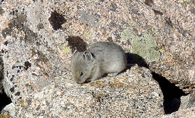
Pika, Rocky Mountain National Park
4.  The scenery and wildlife viewing are fantastic.  Even if you don't make it to the peak, the hike is
well worth it.  We saw marmots, pikas, elk, and ptarmigans up close. Bighorn sheep and other wildlife are also often seen along this route.  In the summer, tiny, delicate, incredible wildflowers are blooming all over.  If at all possible, make it to the keyhole to take in the fantastic view on the other side.

5.  Take plenty of water, food, and clothing.  We each drank at least 2 quarts of water/energy/electrolyte beverages.  3-4 quarts is recommended.  Weather ranged from warm and sunny to cold, windy, hail and rain.

6.  Take a first aid kit and duct tape.  Lots can go wrong on this hike/climb and timely help isn't guaranteed.  We came across a hiker with a boot blowout and aided his hike down by providing him with some duct tape.  You can sometimes find duct tape in tiny rolls or roll your own by wrapping it around a toothpick or something small so it takes up less space.  As mentioned earlier, Ibruprofen or Naproxen can help alleviate some common symptoms of altitude sickness.

Our trip


Hiking at 3:30 AM with a Headlamp
We camped at the Longs Peak Campground for two nights.  The campground borders a private summer camp which can cause noise and traffic issues if you have bad timing like we did.  We set our alarms for 3:00 AM and were hiking towards the trailhead at around 3:30.  Lots of people were up and making noise at the campground at 2:00 which may be a smarter time to get up for multiple reasons.

Hiking at dark with a headlamp was a new experience for me and it was fun, though at times I felt like I was walking in a trance.  There was fairly full moon and some hikers didn't bother with lights.

The route to the summit is 7.5 miles long and includes roughly 5,000 ft. of elevation gain.  The last 1.7 miles of the route is not a trail and is more of a scramble/climb over boulders, past sheer cliffs, and up steep rock faces which is why averaging just over one mile an hour (there and back) is pretty normal.

Sunrise began around 5:15 or 5:30 and we got an amazing show having reached a location somewhat near the treeline.  There are two toilets along the route which is nice since privacy is limited above the trees.  We saw lots of wildlife on our hike including numerous elk, pikas, and marmots at close range. Along the way I heard two of my favorite wildlife noises: elk bugling and hermit thrush songs.


Sunrise from the Longs Peak Trail
The Keyhole. Longs Peak
We made it through the Boulder Field and up to the Keyhole by around 11:15 (which is probably too late).  The view from the Keyhole was awesome, but the route beyond it was a little too much for me and many people I talked to.  The rest of our party continued on, only to turn around on the Trough due to time and weather concerns.

These concerns were validated by the fact that there was a thunderstorm with lightning and hail at 1:30.  The storm caught many people out in the open, while I managed to shelter under a large rock downhill from Chasm Lake but not quite below the treeline.

We got rained on for much of our remaining hike back to the trailhead but were able to dry off quickly when the sun returned.


Fork to Chasm Lake

Elk Herd Near the Boulder Field


Boulder Field Campsite - Exposed and Windy


View from the far side of the Keyhole

The Ledges

Colorado Small Mammal Pika
Pika, Rocky Mountain National Park
Ptarmigan

View Longs Peak in a larger map 

Golden Trail and Whitewater Park


Golden, Colorado is a cool little college town with tons of outdoor recreational opportunities.  It is nearly surrounded by parks in the foothills with hiking trails and to top things off, Clear Creek runs right through the heart of the city offering fun for tubers, kayakers, and reckless swimmers.  The Clear Creek Trail runs along both sides of the creek, which enabled us to rent tubes, put in upstream, float about half a mile down and walk back up to do it all again.  The creek has a whitewater park with some man-made rapids which are pretty exciting to go over.
The Trail Was Flooded, but that Just Means More Floating


Photo By Lindsay Smith

Photo By Lindsay Smith

Red Rocks

Though it actually came first chronologically, I didn't do much of the trail, so I just wanted to note here that Red Rocks has a few trails.  If you go there for a show, get there a couple hours early and take in the natural beauty of the place.


Trading Post Trail at Red Rocks


More photos and information on hikes in Rocky Mountain National Park can be found in my previous post at:
http://trailsofarkansas.blogspot.com/2013/12/rocky-mountain-national-park-of-week-6.html

Or on the NPS website:
http://www.nps.gov/romo/index.htm

Sunday, July 6, 2014

JB Hunt Park / Lake Springdale

JB Hunt Park in Springdale has roughly three miles of paved trail and a short gravel nature trail.  The paved trail contains several loops, some overlapping, so you can easily tailor the distance to your liking.  The asphalt trail is in somewhat poor shape in places, though that may change soon when the trail is connected to, and partially overlapped by, the Razorback Greenway.

The trail is steep in places with some sharp, blind turns so watch your speed if you bike it!  The lake allows fishing and the nearby nature trail has a nice wildlife viewing platform; though we saw way more wildlife along the paved trail than we did from the platform.

The park also has a playground, baseball fields, and a very clear, wide open disc golf course that would be great for beginners or people tired of hunting for their discs in the woods and high grass of Lake Fayetteville.

Lake Springdale

Geese in the Way - Lake Springdale

JK3 Riding on the Nature Trail


View Lake Springdale - JB Hunt Park in a larger map

Dogwood Springs Walking Path - Siloam Springs

Today I visited the new Siloam Springs Whitewater Park and then drove into town to explore the Dogwood Springs Walking Path.  While I walked/jogged the trail, there is a great bike rental place downtown near the trail (Dogwood Junction Bike Shop).

I got on the trail downtown, near University and College and followed it westward along Sager Creek through a city park.  The creek has had some restoration work done recently and I saw lots of ducks, herons, and turtles in it.  After nearly 0.5 miles, the trail leaves the creek and follows University onto JBU campus.  There is a water fountain and outdoor fitness station just past the entrance to the university.  My friend got pretty close to a snake crossing the trail in this area.

The long stretches of trail on the west and north sides of campus are the most scenic, as they are forested and offer views of the creek. At about the 1.5 mile mark, the trail passes by the neighboring wastewater treatment plant which detracts a bit from the experience.  From there the trail wraps around campus and runs by Oak Hill Cemetery.  Once you reach Holly St., I would recommend leaving the trail, maybe checking out campus a bit, and then taking University and the trail back to downtown.  This makes for about a 5k for anyone training for a race and avoids the less scenic portions of the trail.  If you choose to stick with the trail, it travels another 1.5 miles south and east past some apartments and schools before dead-ending in a neighborhood with no signs telling you where to go.  I took Carl north to Alpine to Garrett to University, but there are lots of other routes you could take to get back downtown.

This trail switches multiple times between being a real, separated, 8' asphalt trail and just following a sidewalk and it is difficult to follow at times.  Be sure to keep an eye out for Dogwood Springs flags/signs on poles.  Two complaints I have about this trail are that it could use more signage and that it needs to form a complete loop.  If such a campaign doesn't exist yet, JBU or some other community organization should start a movement to "Complete The Loop" like the one underway in Little Rock seeking to finish the River Trail.  I would love to assist with researching ideal routes if anyone needs help.


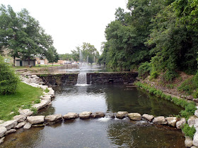
Fountains at Siloam Springs

Great Blue Heron - Sager Creek, Siloam Springs
Outdoor Gym at JBU - Photo by John Kester III


Cathedral of the Ozarks


View Dogwood Springs Walking Path in a larger map