A friend and I started out 2013 with a trip to
Sequoia/Kings Canyon National Park to snowshoe up to the
Pear Lake Ski Hut (followed by a few days at
Joshua Tree National Park). To get somewhat acclimated, we spent a night at
Wuksachi Lodge (7,000') and tested our gear with a short snowshoe around the Giant Forest sequoia grove. After seeing the awe-inspiring General Sherman, The President, Chief Sequoyah, and The Senate trees via some combination of summer, winter, and off-trail routes we drove back to the lodge for a great meal and some sleep.
We took advantage of the satisfying (and warm) breakfast buffet at Wuksachi before packing our backpacks, driving the short distance to Lodgepole to drop off our backcountry permit, and finally driving a few more minutes to the Pear Lake Trailhead at Wolverton. While putting on our packs and snowshoes, we questioned our choice of winter activities while listening to shouts of joy and laughter coming from the nearby snow-play area where people were sledding.
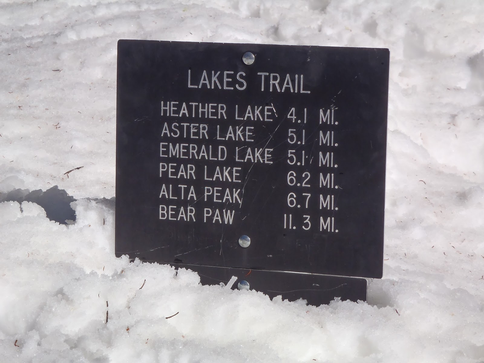
As you can see on the map and elevation graph below, the trek up to Pear Lake is 5-6 miles and involves lots of elevation change. While our route was just over 5 miles, the summer route is less direct, has more switchbacks, and goes a bit past the hut to the campsites at the lake.
The first mile and a half or so were not bad as we worked our way gradually uphill through a fairly dense forested area. At the Panther Trail junction, the route to Pear Lake veers off to the left and heads straight up a long, steep slope nicknamed "The Hump". The next two miles were pretty brutal on our calves (and egos) as we gained about 1,700 ft. in elevation with very little help from any switchbacks. The Hump tops out (after several false summits) at 9,400 ft. and offers some great views while you catch your breath.
From there the trail shot down a steep slope to Heather Lake, which was frozen over. After opting to snowshoe around the lake rather than across it as tracks showed us some people had obviously done, we worked our way up a short, steep incline. From there we went another 0.75 mi. which included another steep downhill section followed by a gradual uphill trudge before deciding to take a break. At this point we thought we had another mile to go based on what maps and route descriptions had told us, but based on what I'd seen in aerial images of the place, I suspected we might be closer. After our break we walked a hilariously short minute or so before seeing the hut which had been hiding right around the corner.
Most people visit the hut in order to ski or snowboard on the nearby slopes. Having only snowshoes, we did a quick dayhike up to Pear Lake, before retiring to the hut for an evening full of conversation and food.
We covered the ~5 miles in at just over 1 mph and the same route out at about 2 mph. Speeds will vary greatly depending on trail conditions, presence of packed snow or fresh powder, personal fitness etc, so be sure to start early and give yourself as much daylight as possible to get there and be prepared to camp on the snow or head back to your car if you aren't making rapid enough progress. We benefited from a well worn path and clear, sunny weather. Under less ideal conditions it could have easily taken us 10 hours to get there.
 |
| Getting Ready |
 |
| Steep Slopes, Few Switchbacks |
 |
| Shortcuts Across Frozen Lakes |
 |
| Getting Close |
 |
| The Hut |
 |
| Ski Hut in Winter, Ranger Station in Summer |
 |
| Dayhike to Frozen Pear Lake |
 |
| Getting Water |
 |
| All Done |