Arkansas is known as The Natural State and prides itself on its natural beauty and outdoor recreational opportunities. People travel to Arkansas to hunt, fish, paddle, and hike, but apparently most Arkansans aren't taking advantage of our state's natural treasures.
I've mentioned elsewhere on this blog that trails have many benefits and I recently wrote up some reasons we should increase trail funding in the state. Three headlines/tweets I read today really highlighted the fact that we are failing to make good use of what our state has to offer:
1. According to data collected by the CDC, Arkansas is the least active state in the country (via WRI on Twitter).
2. Arkansas is the 49th healthiest state according to a report by the United Health Foundation. We rank poorly due to high rates of obesity and smoking.
3. Arkansas is the third fattest state and the only state where adult obesity rates increased last year.
Come on Arkansas! How is it that we have so much outdoor recreational potential in the state and still have all these negative rankings for things that correlate heavily with inactivity? One reason is that we lack walkable communities with recreational infrastructure near our homes. Remember last year when Arkansas was ranked the least bike-friendly state? We clearly need to get people outdoors, and a big part of that is going to involve improving access to trails, sidewalks, parks, and athletic fields/courts.
Here are some things you can do to get involved:
Join and support organizations that work on environmental education, walkable communities, and getting people outdoors.
Research your community's master trails and parks plans.
Join city or county committees that update these plans.
If you want to be more active but need ideas, here are a few:
Go for a walk, jog, hike, or bike ride.
Get a dog. They need to be walked multiple times a day and that means you do too!
Take up disc golf or real golf.
Go paddling. There are great lakes and streams all over Arkansas.
Get a book on trails. There are lots to choose from for Arkansas.
Work in the yard. Get an old-school lawnmower.
Go birding.
Related Articles:
Arkansas Outdoor Resources
Arkansas Trail Resources - Find places to go and people to go with!
If this is your first visit, I encourage you to navigate using the tabs at the top of the page or the labels down the left side. You can also visit the "Using This Site" page.
Pages
▼
Thursday, December 12, 2013
Wednesday, December 11, 2013
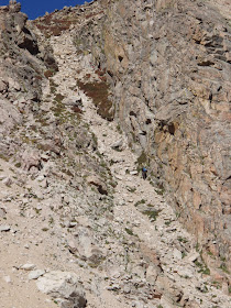
Rocky Mountain - National Park of the Week #6
Rocky Mountain National Park
Location: Northern Colorado, 80 mi. NW of Denver
Area: 275,761 acres
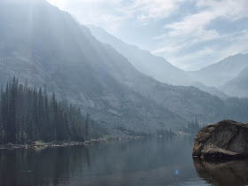
Major Attractions: 72 peaks over 12,000 ft., high alpine lakes, tundra, the Continental Divide
Miles of Trail: 300+
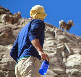
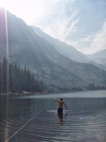
My Favorite Parts: Marmots, Swimming in cold lakes after backpacking
Getting There: Drive west on 34 or 36 from Estes Park to reach the main entrances.
Website: http://www.nps.gov/romo/
Named for a mountain range that spans the continent, Rocky Mountain National Park always feels smaller than it should be. It is way down the list of national parks ranked by size, and this can make finding a longer backpacking route a little tricky. The park does have lots of great day hikes and some longer trails that leave the park. The mountains and high alpine lakes are the main attraction here and they can be enjoyed all seasons of the year.
Location: Northern Colorado, 80 mi. NW of Denver
Area: 275,761 acres
Major Attractions: 72 peaks over 12,000 ft., high alpine lakes, tundra, the Continental Divide
Miles of Trail: 300+
My Favorite Parts: Marmots, Swimming in cold lakes after backpacking
Website: http://www.nps.gov/romo/
Named for a mountain range that spans the continent, Rocky Mountain National Park always feels smaller than it should be. It is way down the list of national parks ranked by size, and this can make finding a longer backpacking route a little tricky. The park does have lots of great day hikes and some longer trails that leave the park. The mountains and high alpine lakes are the main attraction here and they can be enjoyed all seasons of the year.
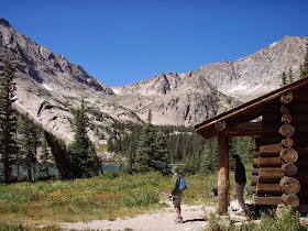 |
| Thunder Lake |
 |
| "Path" to the Pass - Continental Divide |
 |
| Bighorn Sheep near Continental Divide - By Rob Waeger |
 |
| Thunder Lake |
 |
| Smoke over Thunder Lake |
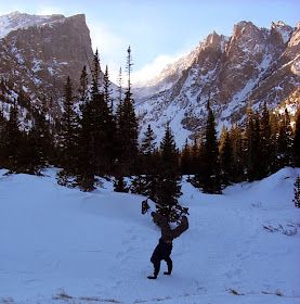 |
| Trails of Arkansas Doing a Handstand - By Katharyn Daniel |
Monday, December 2, 2013
Great Reasons to Increase Trail Funding
 |
| The only thing within walking distance: 3,000 homes just like yours. Where are the parks and stores? |
decisions have placed a high priority on the automobile; typically with little or no thought (or funding) going to alternative forms of transportation including feet, bikes, buses, and rail. This shortsightedness lead to massive sprawled out, low-density cities whose residents are dependent on cars to get groceries, visit friends, and get to work.
This form of city structure is not common in Europe or Asia and makes the United States particularly vulnerable to spikes in the price of crude oil and gasoline. It also ensures that most Americans get little exercise when going about their daily routines.
 |
| Walkable Neighborhood via OpticosDesign |
hours stuck in traffic during their commute or having to drive 20 minutes to get to a restaurant or grocery store. While Arkansas has been slower than places like California, Oregon, Washington, Minnesota, and New York to adopt a higher priority for active/alternative forms of transportation, cities like Fayetteville, Bentonville, and Little Rock have put some impressive trail infrastructure in place and are starting to see the benefits.
Here are some big reasons Arkansas should boost funding for trails and place alternative forms of transportation on the same priority level as cars and highways:
1. People are driving less. This is particularly true for younger people who are waiting longer to get a license and are looking to live in locations that don't require as much driving. More proof that per capita driving is dropping lies in the fact that per capita gasoline consumption is dropping as well.
2. People are walking and biking more. Data collected from the RiverTrail in Little Rock and the Scull Creek/Frisco trail in Fayetteville show steadily climbing usage numbers over the last 5 years. It is clear that adding and connecting trails has helped boost numbers as more people have access to trails that take them more places. The bridge to Two Rivers park off of the River Trail has boosted traffic both on the trails in Two Rivers and along the River Trail. The extensions of the Scull Creek/Frisco/Mud Creek/Lake Fayetteville trail have increased traffic by connecting more and more residential areas, shopping centers, and parks. When complete in 2014, the Razorback Greenway, and the trails networks connected to it, will provide a viable transportation alternative for large numbers of area commuters and shoppers in addition to the thousands of recreational bikers, joggers, and strollers that already make use of the currently completed sections of trail every day.
3. People want walkable, livable communities and see trails as a big part of that. Sprawl in the Fayetteville area has largely been on hold since 2008, while the last five years have seen an explosion in large apartment complexes near the University and The Square. These complexes also happen to be on or near trails or planned trail corridors. In fact, proximity to trails plays a role in LEED certification, something developers of new apartments and office buildings are increasingly seeking.
4. As mentioned elsewhere on this site, trails get people outside and improve our mental and physical health; lowering our medical bills and improving our quality of life. Arkansas is the least active state and one of the least healthy with one of the highest rates of obesity. Spending money prioritizing active transportation and recreation will save our state money on health costs and improve the quality of life of our citizens.
Monday, October 21, 2013
Buffalo River Trail - Steel Creek to Ponca
We took advantage of the recent chilly weather and camped at Steel Creek Campground on the Buffalo National River. Steel Creek has some amazing bluffs and is a nice place for some exciting paddling when the water is up. This particular weekend, it wasn't, so we went for a hike along the Buffalo River Trail. The section between Steel Creek and Ponca is a short 2 miles, but does have a healthy amount of elevation change. With the leaves still on the trees, the views here were good but not incredible. At Ponca, we explored the old James Villines homestead, relaxed by the water, and then walked back to Steel Creek via the trail. If you didn't like the trail, or would like to make a loop instead, you can take the road back, but it is a bit windy and sometimes people don't obey the speed limit!
On our way home, we ate at the Low Gap Cafe and I recommend it to anyone visiting the area. On Sundays they have live music and a buffet. The band we heard played Spanish, Brazilian, American folk, and other unexpected genres of music. I'm told they have music other days as well.
On our way home, we ate at the Low Gap Cafe and I recommend it to anyone visiting the area. On Sundays they have live music and a buffet. The band we heard played Spanish, Brazilian, American folk, and other unexpected genres of music. I'm told they have music other days as well.
5 Largest State Parks in Arkansas
Here are the five largest state parks in Arkansas. Which have you been to? What were your favorite trails?
Note: These rankings are impacted by whether water area is included. Many parks border or contain large lakes and whether the area of the lake should be included in comparisons of this type is a bit of a grey area.
Note: These rankings are impacted by whether water area is included. Many parks border or contain large lakes and whether the area of the lake should be included in comparisons of this type is a bit of a grey area.
1. Hobbs - 12,056 acres. Hobbs State Park-Conservation Area is located on the south shore of Beaver Lake in Northwest Arkansas. It is the largest state park, but is co-managed by Arkansas State Parks, Arkansas Natural Heritage Commission, and the Arkansas Game and Fish Commission. The park has a large visitor center and many miles of hiking and biking trails.
Thursday, October 17, 2013
Everglades - National Park of the Week #5
Everglades National Park
Location: Southern tip of FL. West of Miami, SE of Naples.
Area: 1,508,538 acres
Major Attractions: Huge wetlands, prairie marls, mangrove swamps, unique wildlife.
Miles of Trail: 150+ (Land and Water)
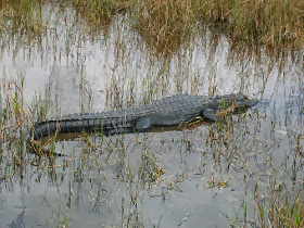
My Favorite Parts: Seas of grass. Alligators! Campsites on platforms in the water.
Getting There: Drive west on US-41 from Miami or east on US-41 from Naples. You can't miss it!
Website: http://www.nps.gov/ever/index.htm
With an average elevation just above sea-level, put this park on your to-see-soon list. Like Glacier National Park, its main attractions could disappear in our lifetimes due to climate change. Everglades National Park is the tenth largest national park in the United States. Most of the park is inaccessible except by boat or fanboat, but the views from the roads and few trails are pretty spectacular. Waterfowl are everywhere and alligators often sun on warm paved surfaces. The canoe trails along the coast that lead to camping platforms in the middle of the water are some of the most unique trails in the country (the platforms provide for relatively mosquito, snake, and alligator free camping). Expensive efforts are underway to restore the Everglades, while invasive pythons, agricultural runoff, and rising sea-levels threaten to destroy the park at least as we know it today. Next time you visit The Keys or Miami, spend a day exploring this amazing park before it is too late!
Location: Southern tip of FL. West of Miami, SE of Naples.
Area: 1,508,538 acres
Major Attractions: Huge wetlands, prairie marls, mangrove swamps, unique wildlife.
Miles of Trail: 150+ (Land and Water)
My Favorite Parts: Seas of grass. Alligators! Campsites on platforms in the water.
Website: http://www.nps.gov/ever/index.htm
With an average elevation just above sea-level, put this park on your to-see-soon list. Like Glacier National Park, its main attractions could disappear in our lifetimes due to climate change. Everglades National Park is the tenth largest national park in the United States. Most of the park is inaccessible except by boat or fanboat, but the views from the roads and few trails are pretty spectacular. Waterfowl are everywhere and alligators often sun on warm paved surfaces. The canoe trails along the coast that lead to camping platforms in the middle of the water are some of the most unique trails in the country (the platforms provide for relatively mosquito, snake, and alligator free camping). Expensive efforts are underway to restore the Everglades, while invasive pythons, agricultural runoff, and rising sea-levels threaten to destroy the park at least as we know it today. Next time you visit The Keys or Miami, spend a day exploring this amazing park before it is too late!
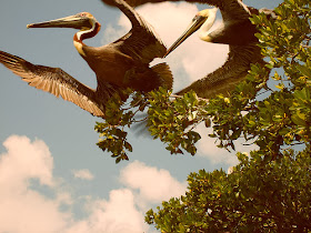 |
| Pelicans, Everglades National Park |
 |
| Trail at Shark Valley, Everglades National Park |
Wednesday, October 16, 2013
Mount Magazine - State Park of the Week #5
Mount Magazine State Park
Location: Western Arkansas. 100 mi. S. of Fayetteville. 100 mi. W of Little Rock.
Area: 2,234 ac.
Major Attractions: Highest Point in Arkansas (2,753 ft). Great Views. Nice Lodge.
Miles of Trail: 20+ Some longer trails leave the park.
My Favorite Part: Easy trails with nice views. Eating at the lodge after a cold night of camping.
Getting There:
From Little Rock: Take Hwy-10 west and then turn right on AR-309. This route is much more scenic than taking the interstate and doesn't take much longer.
From the website:
Mount Magazine State Park is located on Scenic Highway 309 approximately 16 miles south of Paris; or from Danville, travel nine miles west on Ark. 10 to Havana, then go 10 miles north on Scenic Highway 309.
Website: http://www.mountmagazinestatepark.com
Mount Magazine State Park contains the highest point in Arkansas and offers stunning views of the Arkansas River Valley and the Ouachita Mountains. The top of the mountain is somewhat flat and mostly forested, so the best views are found around the rim rather than at the peak. The lodge, cabins, and campsites are very popular in the fall, so be sure to book in advance. There is a network of short trails that take you to various points around the mountain and these connect to longer trails that leave the park.
Tuesday, October 8, 2013
Bryant Trail - Fayetteville
I wasn't expecting much from this trail after spotting it on Fayetteville's GIS map since the map showed a loop trail winding through a complex of county buildings and a jail in an industrial part of town. At a bit over a mile, this trail was full of surprises, most pleasant. Not every trail can claim to pass a jail AND a shooting range. In fact, a section of the trail is closed when the range is active. Besides those landmarks, the trail runs through open grassy areas with some shade trees. As you can see on the map below, the trail overlaps a road for a short distance. This isn't well labeled, so just follow the road until you find the trail again.
Parking for the trail is located off Clydesdale Dr. off of School Ave. in southern Fayetteville.
Parking for the trail is located off Clydesdale Dr. off of School Ave. in southern Fayetteville.
Saturday, October 5, 2013
The Southwest Trail
Plans are being developed for a trail between Little Rock and Hot Springs. This 50-mile trail would follow the old Rock Island Railroad track and would be one of the longest Rails-to-Trails projects in the country. One of the great things about using old railroad beds is that much of the earth-moving and grading work is already done and you are guaranteed a trail with no steep slopes (which is no easy task when passing through the Ouachitas).
Many local officials from counties and cities along the path have expressed interest, so now the big question is where the ~$20 million will come from. Funds for these types of projects often come from a variety of sources including federal transportation dollars, as well as state, county, and city funds. Arkansas gets roughly $10 million a year in federal Transportation Alternatives funds, but these don't go just to trails. It should be noted that funds for trails via this program and from more local sources are under constant threat these days by political parties and groups that think all transportation dollars should go towards expanding highways and repaving roads as part of an unbalanced "cars only" approach to transportation policy. If we want more funding for trails, we need to encourage our lawmakers to protect existing funding sources and pass local initiatives similar to the statewide 1/8th cent conservation sales tax and the sales tax increase that Little Rock recently passed in part to fund parks and trails.
This trail would help complete the second side of the "city-in-a-park" trail triangle that is part of the Little Rock Parks Master Plan.
The Prezi below, by Mason Ellis, has more details on the project.
Friday, October 4, 2013
River Trail Updates
On a recent trip to the bridge at Two Rivers Park, I noticed the large scale sculpture/model of the Arkansas River showing major points of interest along the trail. The concept of the River Trail has recently been extended to Pinnacle Mountain State Park on the south side of the river and to Palarm Park on the north. In fact, plans are in place for a "Grand Loop" (shown below) that would reach Conway. Much of the existing River Trail and the Grand Loop follow roads. As long as the speed limits on these roads are 20-25 mph, that is pretty safe, but hopefully a separate trail will be built for the stretches on larger roads with faster moving traffic.
Key Points:
The original map and up-to-date info can be found at: http://arkansasrivertrail.org/maps/
Key Points:
- The trail follows Crystal Hill Rd. in Maumelle for a while. This allows it to be closer to the river and gets bikers off of busy, fast moving, Maumelle Blvd.
- It looks like they are making a real trail along the edge of parts of Maumelle Blvd.
- Maumelle has a great network of existing trails that will either form part of the River Trail or make for interesting, scenic detours. This will also make it easier and safer for residents of Maumelle to commute by bike to work in North Little Rock and Little Rock.
- On the south side, the trail extends to Two Rivers Park via the new bridge, and then to Maumelle Park. I believe the separate trail ends there and the River Trail follows Pinnacle Valley Rd., AR-300, AR-113, AR-60, and AR-89 for most of the Grand Loop.
The original map and up-to-date info can be found at: http://arkansasrivertrail.org/maps/
View River Trail Expanded in a larger map
Wednesday, October 2, 2013
Coleman Creek Greenway UPDATE
A new stretch of the Coleman Creek Greenway will open soon on the UALR campus. The new section, running between 28th and 20th St. will double the length of the existing trail and increase the trail's connection to the community. This new section travels through a forested part of campus and should feel a bit more natural than the southern half which closely parallels roads and parking lots for much of its length. One day, this trail may run from Markham, south through War Memorial Park, through UALR, and down to Fourche Creek, where it will hopefully connect to other trails following Rock Creek and Fourche Creek coming in from Hindman Park, Boyle Park, and Fourche Bottoms.
Yosemite - National Park of the Week #4
Yosemite celebrated its 123rd birthday this week and is one of my favorite parks, so it was the natural choice for this week's NPOTW.
Yosemite National Park
Location: Eastern CA. 190 mi. E of San Francisco, 100 mi. N of Fresno
Area: 748,000 acres
Major Attractions: Massive granite domes, scenic glacier-carved valleys, stunning waterfalls, sequoia groves
Miles of Trail: 750+
My Favorite Parts: High Sierra Lakes, Backcountry Vistas, Granite Domes
Getting There: From Fresno: 2 hours - Drive north on CA-41
From Bay Area: 3 hours - I-580 E, I-205 E, I-5 N (short!), CA-120 E
Website: www.nps.gov/yose/
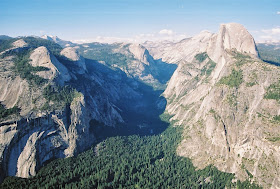
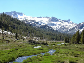
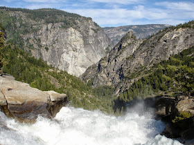
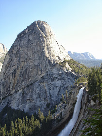
Established as the third National Park in the country, Yosemite is one of our country's most iconic parks. Its jaw-dropping glacier-carved valleys with their incredible waterfalls and huge exposed granite faces and domes are hard to beat in terms of sheer scenic beauty. Besides the summer traffic, my main complaint about the park used to be its lack of wildlife, however, after my last trip there I can no longer make that complaint. The most famous views in the park are in Yosemite Valley and from Glacier Point. I think Hetch Hetchy Valley and views of Mono Lake from the eastern edge of the park are just as spectacular. If you hate crowds and traffic, Yosemite has an enormous backcountry/wilderness area. With the exception of the hike to and up Half Dome, my general rule of "once you hike two miles into the wilderness the crowds disappear" holds true. For this reason the backcountry is my favorite part of the park. Views often look better when you have to work for them (and when there are no crowds of strangers in the way); and for that reason I find the views around Ten Lakes, Parker Pass, Cathedral Peak, and Clouds Rest to be some of the best in the park.
Yosemite is beautiful year-round, but late spring is probably the best time to visit to see the waterfalls in their full glory. If you are looking to backpack and want to avoid crowds, high temperatures, and walking on snow, the fall is probably ideal.
My other piece on Yosemite can be found at:
http://trailsofarkansas.blogspot.com/2013/06/hetch-hetchy-yosemite-national-park.html
California Readers: Interested in getting paid to unplug your laptop or turn off a light for an hour? $20 just for joining OhmConnect, learn more at: https://login.ohmconnect.com/ref/30315
Yosemite National Park
Location: Eastern CA. 190 mi. E of San Francisco, 100 mi. N of Fresno
Area: 748,000 acres
Major Attractions: Massive granite domes, scenic glacier-carved valleys, stunning waterfalls, sequoia groves
Miles of Trail: 750+
My Favorite Parts: High Sierra Lakes, Backcountry Vistas, Granite Domes
From Bay Area: 3 hours - I-580 E, I-205 E, I-5 N (short!), CA-120 E
Website: www.nps.gov/yose/
Established as the third National Park in the country, Yosemite is one of our country's most iconic parks. Its jaw-dropping glacier-carved valleys with their incredible waterfalls and huge exposed granite faces and domes are hard to beat in terms of sheer scenic beauty. Besides the summer traffic, my main complaint about the park used to be its lack of wildlife, however, after my last trip there I can no longer make that complaint. The most famous views in the park are in Yosemite Valley and from Glacier Point. I think Hetch Hetchy Valley and views of Mono Lake from the eastern edge of the park are just as spectacular. If you hate crowds and traffic, Yosemite has an enormous backcountry/wilderness area. With the exception of the hike to and up Half Dome, my general rule of "once you hike two miles into the wilderness the crowds disappear" holds true. For this reason the backcountry is my favorite part of the park. Views often look better when you have to work for them (and when there are no crowds of strangers in the way); and for that reason I find the views around Ten Lakes, Parker Pass, Cathedral Peak, and Clouds Rest to be some of the best in the park.
Yosemite is beautiful year-round, but late spring is probably the best time to visit to see the waterfalls in their full glory. If you are looking to backpack and want to avoid crowds, high temperatures, and walking on snow, the fall is probably ideal.
My other piece on Yosemite can be found at:
http://trailsofarkansas.blogspot.com/2013/06/hetch-hetchy-yosemite-national-park.html
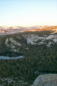 |
| Near Ten Lakes |
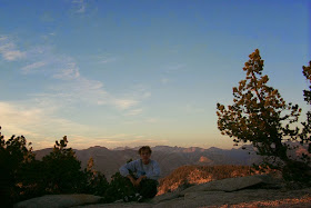 |
| Near Ten Lakes |
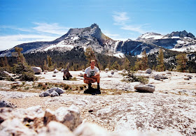 |
| Dome Near Cathedral Peak, Yosemite National Park, California |
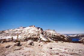 |
| View Near Medlicot Dome |
 |
| Waterfall - Yosemite |
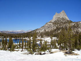 |
| Cathedral Peak |
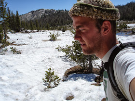 |
| Unhappy about Backpacking on Snow |
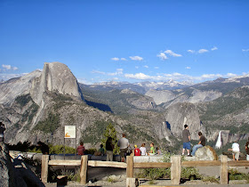 |
| Glacier Point |
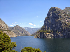 |
| Hetch Hetchy Valley |
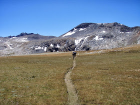 |
| Trail to Ireland Lake, Yosemite |
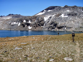 |
| Ireland Lake |
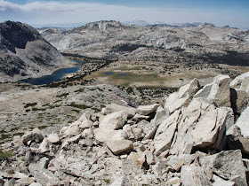 |
| Looking Towards Townsley Lake and Vogelsang from ridge near Ireland Lake |
California Readers: Interested in getting paid to unplug your laptop or turn off a light for an hour? $20 just for joining OhmConnect, learn more at: https://login.ohmconnect.com/ref/30315
Thursday, September 26, 2013
Crater of Diamonds - State Park of the Week #4
Crater of Diamonds State Park
Location: SW Arkansas. 2 mi. S. of Murfreesboro. 108 mi. SW of Little Rock.
Area: 911 ac.
Major Attractions: Digging for diamonds!
Miles of Trail: 2.6
My Favorite Part: Attempting to get rich quick. As a child it was finding cool rocks and playing in the dirt.
Getting There: From the website:
From Little Rock - Travel west on I-30 approximately 56 miles and take exit #73 at Arkadelphia, then go west on Ark. 51 for six miles, then follow Ark. 26 for approximately 34 miles to Murfreesboro. From the courthouse square in downtown Murfreesboro (North Washington Avenue), travel two miles southeast on Ark. 301 to the park.
From Texarkana - Go east on I-30 for 30 miles and take Exit #30 at Hope. Take U.S. 278 north and go 27 miles to Nashville. From Nashville, take Ark. 27 north and go 13 miles to Murfreesboro. From the courthouse square in downtown Murfreesboro (North Washington Avenue), travel two miles southeast on Ark. 301 to the park.
Website: http://www.craterofdiamondsstatepark.com
Crater of Diamonds State Park sits on top of an old volcanic crater. It is the only place in the world where the public can search for diamonds and keep whatever they find. Of course, income from park entrance fees, the cafe, the water park, and equipment rentals probably eclipse whatever the state could make off the diamonds found at the site. As a child, I enjoyed playing in the dirt and finding interesting rocks. Grownups enjoy the thought of taking home a large, unique, and valuable diamond. Only a small portion of the park's area is cleared for diamond hunting, leaving much of the park wooded. There are 3 short trails at Crater of Diamonds that offer views of interesting geological features and the Little Missouri River.
Big Bend - National Park of the Week #3
Big Bend National Park
Location: SW Texas. 320 mi. SE of El Paso, ~100 mi. S of Marfa and Alpine
Area: 801,000 acres
Major Attractions: Incredible cliffs and views in Chisos Mountains, Sheer canyons on Rio Grande
Miles of Trail: 150+
My Favorite Parts: South Rim, Ernst Tinaja, Santa Elena Canyon, Javelinas (I haven't seen any yet)
Getting There: 4 hours from Midland - W on I-20, S on TX-18, S on US-385
5 hours from El Paso - E on I-10, E on US-90, S on US-385
Website: http://www.nps.gov/bibe/
Big Bend lies in the Chihuahuan Desert and contains the entire Chisos Mountain range. The park is named after a large bend in the Rio Grande, which makes up its southern border. Major attractions at the park include floating the Rio Grande, taking in spectacular desert scenery from the South Rim, climbing Emory Peak, and getting in some of the best stargazing on the planet. My favorite time to visit the park is in the spring when cacti are in bloom and temperatures allow for comfortable backpacking trips. You will miss out on much of the park unless you take a vehicle that can handle the rough dirt roads that traverse the southern portion of the park.
My less formal piece on Big Bend can be read here.
Location: SW Texas. 320 mi. SE of El Paso, ~100 mi. S of Marfa and Alpine
Area: 801,000 acres
Major Attractions: Incredible cliffs and views in Chisos Mountains, Sheer canyons on Rio Grande
Miles of Trail: 150+
My Favorite Parts: South Rim, Ernst Tinaja, Santa Elena Canyon, Javelinas (I haven't seen any yet)
5 hours from El Paso - E on I-10, E on US-90, S on US-385
Website: http://www.nps.gov/bibe/
Big Bend lies in the Chihuahuan Desert and contains the entire Chisos Mountain range. The park is named after a large bend in the Rio Grande, which makes up its southern border. Major attractions at the park include floating the Rio Grande, taking in spectacular desert scenery from the South Rim, climbing Emory Peak, and getting in some of the best stargazing on the planet. My favorite time to visit the park is in the spring when cacti are in bloom and temperatures allow for comfortable backpacking trips. You will miss out on much of the park unless you take a vehicle that can handle the rough dirt roads that traverse the southern portion of the park.
My less formal piece on Big Bend can be read here.
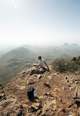 |
| South Rim |
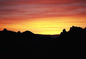 |
| Sunset |
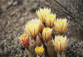 |
| Cacti in Bloom |
Wednesday, September 25, 2013
Big Creek Hog Farm Near Buffalo National River
Update 1/22/2015: According the an article on ParkAdvocate: "U.S. District Judge D. Price Marshall found two federal agencies liable for illegally guaranteeing portions of approximately $3.6 million in loans applied for by C&H Hog Farms, a 6,500-animal factory farm that began operating on a tributary of the river in 2013. The two federal agencies—the Small Business Administration (SBA) and the Farm Service Agency (FSA)—guaranteed these loans despite failing to conduct adequate environmental reviews."
Update 5/3/2014: The Arkansas Pollution Control and Ecology Commission passed a 6-month moratorium on hog farms in the Buffalo River Watershed. They also initiated a rule-making process to consider a permanent ban on medium and large hog operations in the watershed. This is a good start, but there is lots of work to be done to protect water quality in the Buffalo River and around the state.
I've now attended multiple talks by UA professors on the state's monitoring plan. Two questions arise that I don't think have been answered adequately:
1. Why did the researchers not disclose the fact that nutrient application fields were mislabeled/misrepresented in the permitted plan? They claim they didn't view it as their scientific duty, but science (I'm a scientist among other things) is about discovering the truth. In not disclosing this information to the public they were knowingly perpetuating a falsehood and that isn't what science is about.
2. Is the current, funded, monitoring plan adequate to definitively determine if the Cargill Hog Farm has negative impacts on Big Creek and the Buffalo River? I don't think it is and two professors I've heard from on both sides of the issue have said as much. The major flaws are that no funding is in place for accurate groundwater flow or nutrient sourcing studies. The research team wants funding for dye-tracer studies. There should be isotopic or other studies done to determine the source of nutrients found in the Buffalo. There should also be more monitoring and karst mapping on fields where application is actually taking place. Due to funding and landowner concerns, very few actual application fields are being monitored.
Update 2/12/14: Read this incredible letter from Earthjustice to ADEQ showing how C&H has been intentionally misrepresenting facts about its nutrient management plan to ADEQ, UA researchers, and others. The letter also accuses C&H of spending and wasting taxpayer dollars via multiple sources despite their connection to Cargill, a private company with annual revenues over $100 billion.
Original Article:
The USDA and Arkansas Dept. of Environmental Quality issued permits to C&H Hog Farm to operate a CAFO (Concentrated Animal Feeding Operation) along Big Creek near Mt. Judea. The perceived weakness of the permit applications, and the permitting process in general, in addition to the fact that the farm is located in the Buffalo River Watershed roughly five miles from the Buffalo, have alarmed paddlers, environmentalists, and locals concerned with air and water quality impacts in their community. From the hog farm landowners' perspective, they followed all the rules, got their permits, took out large loans and have already begun bringing in hogs.
Due to water quality concerns and the importance of the Buffalo River (our nation's first National River and a major tourism draw), the Arkansas legislature approved the use of ~$340,000 of rainy day funds to study impacts of the hog farm and its proposed application of hog waste to nearby fields. Many of the proposed application fields border Big Creek and are in its floodplain. The fields will likely reach nutrient saturation within a short period of time and will probably contribute nutrients and biological contaminants to Big Creek and the Buffalo River. Ideally, the testing that will be performed by University of Arkansas researchers would take into account all possible routes for pollution to travel from the farm into the Buffalo River, however some of the university's professors already argue that isn't the case. I attended a presentation by Dr. Van Brahana, a Prof. Emeritus at UA, during which he argued that monitoring plans were insufficient as they didn't even mention karst or karst-related groundwater transport. This area of the state happens to have lots of karst (see map below), which allows for rapid transportation of water underground. This also means that pollutants aren't attenuated before they reach surface waters, such as the Buffalo or Big Creek in this case.
A lawsuit has been filed against the "U.S. Department of Agriculture Farm Service Agency (FSA) and the U.S. Small Business Administration (SBA) for their inadequate review and improper authorization of loan guarantee assistance to C&H Hog Farms". "Earthjustice, Earthrise Law Center, and local attorney Hank Bates are representing the Arkansas Canoe Club, Buffalo River Watershed Alliance, National Parks Conservation Association, and The Ozark Society".
One of the least discussed aspects of this story is that CAFOs fall under the General Permit system at ADEQ. General Permits are designed to be quick and easy to get and it is very difficult for ADEQ to deny a general permit application without risking a lawsuit. Few if any environmental organizations testified when ADEQ was deciding to place CAFOs under the general permitting system. If we want to prevent other CAFOs from popping up, this is something structural we need to change. Many states already ban CAFOs or specific practices often used by CAFOs. North Carolina, a huge pork producer, after having horrific spills from hog waste lagoons following a hurricane, has banned the construction of any new lagoons.
Let me know if I'm missing any important aspects of this issue or if I've gotten something wrong.
Links to More Information:
Lots of Documents and Background via Buffalo River Watershed Alliance
Hog Farm Near Buffalo Raises Concerns
Legislature Approves Funding for Water Testing at Hog Farm - ArkTimes
TNC Karst Program
ADEQ Site Inspection Report
How You Can Help:
Elect people who want to strengthen environmental protection and enforcement. Weak enforcement of existing laws is a big issue in AR.
Lobby legistlators and ADEQ to remove CAFOs from the general permit system or to ban CAFOs entirely (other states have already taken this step).
Encourage NPS, US Forest Service, State Parks, etc. to acquire entire Buffalo River watershed
Join the organizations mentioned above or here. Or at least get on their mailing lists.
 |
| Blue and Green Show Karst Areas. Red Star - Location of Hog Farm |
Green Arrow - Hog Operation Site. Red - Waste Application Fields
View Hog Farm in a larger map
Proximity of CAFO to Big Creek and Buffalo National River.
View Hog Farm in a larger map






.jpeg)
