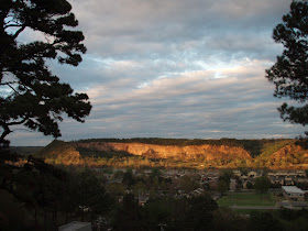
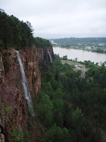
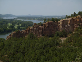
Some friends and I had a very interesting trip to the Buffalo this weekend. I can now say from experience that 3.3' on the St. Joe gage means the water is too low to comfortably paddle in the Tyler Bend/Gilbert area (4 to 6 or 8 feet is typically considered ideal). It would have been a nightmare in a canoe and we saw one family turn back after about two miles. We were all in kayaks and still had to walk more than a few times. On the plus side, Buddy swam and ran most of the way from Tyler Bend to Gilbert and since the river wasn't crowded with paddlers, we saw lots of great wildlife including: a river otter, a mink, and a bald eagle in addition to the usual turtles, kingfishers, and green and great blue herons.
On the day after our float, we went upstream to checkout Woolum and were confused to find the river had some flow upstream of the put-in but was BONE DRY downstream of the bluffs there for a mile or more! So after swimming briefly in the chilly pool by the bluffs and in the warmer, shallower pool just upstream of there, we took a unique hike down the dry channel of the Buffalo River. To my disbelief, we didn't find any hidden treasure, but we did find bones, bleached crawdads, a few cans, and lots of interesting rocks and rock formations.
You can access the Buffalo River Trail and some other trails from Woolum. We started on one but due to its overgrown condition and my paranoia of ticks and chiggers in August, we opted for the wide open dry channel of the Buffalo instead.
The following pages have more information on finding ideal water levels for floating the Buffalo:
http://trailsofarkansas.blogspot.com/search/label/Floats
http://ar.water.usgs.gov/buffaloriver/
If this is your first visit, I encourage you to navigate using the tabs at the top of the page or the labels down the left side. You can also visit the "Using This Site" page.
Pages
▼
Monday, August 20, 2012
Wednesday, August 15, 2012
Valuable Bike Information for Incoming UA Freshmen
With an ever growing campus and student body, owning a bike to get between classes and around town is becoming an increasingly good idea and a necessity for some. At the same time, biking around campus has never been more difficult given the construction, lack of bicycle parking, and crowded roads and walkways. With the number of students enrolled approaching 25,000, up 5,000 from just 3-4 years ago, it is no surprise the campus is undergoing some growing pains. With that in mind, here are some useful tips for students looking to bike on campus:
1. Register your bike. This helps the campus realize how many people are actually biking and will encourage them to budget more money for bike infrastructure.
2. Don't give up. Lots of students buy bikes, ride them once, and give up due to steep hills, lack of parking, and other issues. Explore campus, use this site and others listed below to find hidden bike racks and better routes to get where you need to go. Give your legs a couple weeks to get used to the hills.
3. Learn the rules. Find out if you can keep your bike in your dorm room or apartment. Dorms on campus are one of the main places lacking sufficient parking spots. Wear a helmet, bike on roads and trails when possible, dismount in busy pedestrian areas. Get lights for biking after dark.
4. Buses have bike racks. If you live a long way from campus, you can ride the bus and bring your bike to help you get from one side of campus to the other between classes.
5. Check out Razorbikes a free bike-loan program on campus.
6. The maps below show locations of parking spots and popular biking routes through campus. Click to view the bike routes map in Google Maps so you can see the legend. (Red = steep or busy, Green = less steep)
7. Make your voice heard. There is a perception among some in the administration that there is plenty of bike infrastructure in place on campus and this couldn't be further from the truth. If you have trouble finding a place to lock your bike or don't feel safe on the roads around campus with no bike lanes let people at Facilities Management and the Transit and Parking Department know.
8. Stay up on the construction closures on campus
Sites with information on biking on campus and around Fayetteville:
City of Fayetteville Trails and Greenways - Maps, Rules, Tips
Office of Campus Sustainability
Bicycle Coalition of the Ozarks
For more information on biking on campus check out my other articles:
http://trailsofarkansas.blogspot.com/2012/01/biking-on-campus.html
http://trailsofarkansas.blogspot.com/2011/10/bikes-on-campus-at-ua-fayetteville.html
Sunday, August 12, 2012
Emerald Park and River Trail News
Update 2/3/15: Big News on Emerald Park and Big Rock Quarry can be found here.
http://trailsofarkansas.blogspot.com/2015/01/emerald-park-big-rock-quarry-burns-park.html
Emerald Park and the River Trail both receive lots of coverage on this blog and in Trails of Central Arkansas. Emerald Park has some great trails and some of the most incredible scenery Arkansas has to offer, which is why its waterfalls are included on the cover of my book. The River Trail is one of the best and smartest things the governments of central Arkansas have ever done. It helps attract businesses and people back into our urban core and improves residents' quality of life.
For these reasons it is shocking that the city of North Little Rock would consider marring this priceless view and recreational resource by selling greenspace to a private developer. Parkland is rarely recovered from developed land, so cities should be careful about selling their openspace to developers. Anyone who has biked the entire River Trail knows that the North Little Rock side is vastly superior to the Little Rock side due to the large parks and natural areas on that side as well as the fact that you have to compete with traffic for a large section of the Little Rock side. This plan would hurt the North Little Rock section of the trail in both these categories by removing greenspace from a section of the trail and increasing vehicular traffic to River Road and the park area.
If you live in North Little Rock, let your elected officials know how you feel about selling greenspace to private developers or attend the City Council meeting this Monday (August 13, 2012) where the sale and development plans will be discussed.
Here are some other sites with information on the proposed sale:
http://www.todaysthv.com/news/article/222056/2/At-6-New-proposed-development-along-River-Trail-
http://jbarcycling.blogspot.com/2012/08/the-quarry-land-saledevelopment-proposal.html
And a Facebook page: https://www.facebook.com/groups/savebigrockquarry/
UPDATE:
The development proposal has been pulled from the agenda for the next city council meeting. I don't know if that means the plan is dead or just in hibernation. If you live in North Little Rock you should push to have that area officially zoned as parkland so this type of plan won't pop-up again.
Do we really want to ruin this?
Friday, August 10, 2012
Lake Wedington Swim (Swimming Holes #3)
After biking the Lake Wedington Loop yesterday, my friend and I cooled off by swimming in the lake. The water was clearer than I expected and the designated swim area has a nice sand and gravel bottom over much of it. While not chilly, the water was still refreshing on a 95-degree day. Unlike the swimming holes I described here and here, this spot has convenient facilities that are open much of the year.
Lake Wedington is about 13 miles west of Fayetteville on Wedington Dr./AR-16. The lake has a day-use fee, but makes for a great place to swim, especially following a bike ride or hike on one of the lakes trails.
Lake Wedington is about 13 miles west of Fayetteville on Wedington Dr./AR-16. The lake has a day-use fee, but makes for a great place to swim, especially following a bike ride or hike on one of the lakes trails.
Lake Wedington Loop #2
Yesterday I got suckered into my first bike ride of the summer despite my aversion to exercising in non-aquatic environs in August in Arkansas. My friend and I drove out to Lake Wedington and did the 19-mile loop used in the Ozark Valley Triathlon. Though it requires driving, this route is much nicer and has less traffic than the ride to the lake from Fayetteville. As you can see on the terrain map below, the route is fairly flat, but does have a couple significant hills. While I enjoyed the ride, it left me wishing I'd invested in bike shorts and some cold Gatorade. After finishing, we cooled off with a swim in the lake.
Thursday, August 9, 2012
Olympic National Park
Updated 8/19/2015: I'm going back to Olympic later this month. You can see more photos from other trips I took there (with a dog) at this link.
Pardon the off-topic post, but I just got back from a week at Olympic National Park, where I did lots of day hikes and my third backpack trip in the park. Most major national parks are known for one or two things; Yosemite - huge, awe-inspiring, light-colored single-slab granite mountains and towering waterfalls, Yellowstone - wildlife and geothermal features, Grand Canyon - a big canyon, Rocky Mountain - mountains, Sequoia and Redwood - huge trees, etc. In contrast to these places, Olympic National Park is spectacular for its great diversity. The roughly 1 million acre park contains scenic foggy beaches, temperate rainforests dripping with dozens of species of moss, and high alpine peaks home to gorgeous wildflower-packed meadows and incredible glaciers. It also has hot springs, amazing waterfalls, and its fair share of wildlife. The multi-colored pebble and sand beaches are lined with massive logs and some are home to tide pools full of starfish, anemones, and other interesting organisms that can be explored during low tide.
All these features are within an hour or two drive of each other and provide endless opportunities for exploration for all ages as the park has a great balance of short, paved trails and longer more primitive trails. In my opinion, July-September is the best time to visit the park unless you love cold rain and mountains of snow. Be sure to bring bug spray!
Right now, the Forks area is in a bit of predictable Twilight madness, which can be fun or annoying based on your feelings towards the movies/books.
The map and photos below show some of my favorite places and hikes.
 |
| Hole-In-The-Wall - Rialto Beach |
 |
| Hoh Rainforest |
 |
| Lake Crescent |
 |
| Obstruction Point |
 |
| Obstruction Point |
 |
| Seven Lakes Basin |
 |
| Hoh Lake |
 |
| Tidepool at Rialto Beach |
View Olympic National in a larger map


