Yesterday, I went to Lake Fayetteville again and it turned out to be a great day for birding and seeing some interesting aquatic life. I walked most of the nature trail around the lake and while I enjoyed all of it, I did appreciate some parts much more than others. The map below shows the trails around the lake. Blue represents paved trails and roads, green represents my favorite sections of unpaved trail, and orange represents my least favorite. Though all the dirt trails are referred to as part of a nature trail, the ones around the outside edge of the park on the north side are really more for mountain biking and running, as they go through less scenic areas often by roads. The trails shown in green felt more like a true nature trail, with great views of the lake, lots of wildlife, plenty of solitude and no bikes whizzing by.
If this is your first visit, I encourage you to navigate using the tabs at the top of the page or the labels down the left side. You can also visit the "Using This Site" page.
Pages
▼
Sunday, January 29, 2012
Sunday, January 22, 2012
Lake Wilson - Joe Clark Trail
Today I drove out to Lake Wilson Park to explore the Joe Clark Trail and the adventure began before I got to the lake since Wilson Hollow Rd. was closed for repairs. After checking the map, I decided to take an alternate route to the park via Schaeffer Rd., which turned out to be a gravel road that had seen better days.
According to Access Fayetteville, there are 3.1 miles of trail in the park, but the route I took, the outer loop, is about half that. A full map can be found here. I hope to visit again in the spring and check out the other routes. My favorite part of the trail was the interesting rock outcropping near the southeastern corner of the trail. The worst part of the trail were the numerous dump sites near the northeast corner of the lake.
Updated 10/8/13 - The map below now shows all the trails.
Updated 10/8/13 - The map below now shows all the trails.
Thursday, January 19, 2012
Using GPS Coordinates in Trails of Central Arkansas
If you've purchased a copy of Trails of Central Arkansas or Trails of Little Rock, you have probably noticed that coordinates are provided for every trail. In Trails of Little Rock, on the first page, I describe how to make use of these coordinates online. This information wasn't provided in Trails of Central Arkansas, so here it is:
GPS coordinates provided can be entered into Google Maps or Google Earth to help you get directions to each trailhead. You can use a space instead of the degree symbol. For example you would just type 34 50'22.26"N 92 29'34.64"W into the box at maps.google.com to find out where the West Summit Trailhead at Pinnacle is. In fact, I'm not sure it always works, but you can even leave out the ' and " and leave spaces instead, for example, entering 34 45 19.50N 92 24 25.19W takes you to the Rock Creek Trail.
You can right click any location on the map and choose "directions to here" to get driving directions. Be sure to enter an address for your current location on the left as well.
Saturday, January 14, 2012
Mount Sequoyah Woods
Mount Sequoyah Woods in Fayetteville has a lot in common with Little Rock's Allsopp Park. Both are large forested parks with numerous dirt trails, located in hilly areas next to nice, older neighborhoods, near downtown. Both feature pavilions, some paved trails, and multiple small streams.
Today I drove up to the top of Mount Sequoyah for my first trip into the park. I parked on the gravel by the cellphone tower near the intersection of Williams Dr. and Skyline Dr. though there are additional, more developed, entrances at the intersection of Happy Hollow Rd. and Paddock Rd. and Sapphire Dr. and Amethyst Ct.
My favorite things about this park were the stream crossings, the stretches of trails lined with inland sea-oats, and the interesting rock bluff.
Saturday, January 7, 2012
Joshua Tree National Park - Things to Do
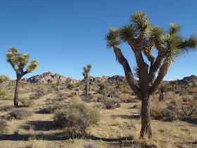
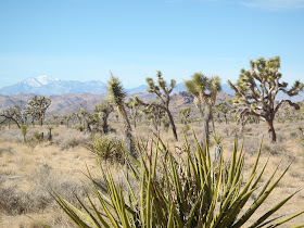
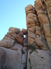
Located about two hours east of LA, Joshua Tree National Park is a popular climbing, bouldering, hiking, and camping destination. I visited this park in January of 2013 and had a great time scrambling over fascinating wind-carved rock formations and hiking through sections of the two distinct deserts that meet in this park, the Mojave and Colorado. The northwest part of the park seems moister and is home to the eponymous Joshua Trees that would would not be out of place in a Dr. Seuss book. The southeastern part of the park is at a lower elevation and has lots of creosote plants, tall ocotillos, and cholla cacti. The small unincorporated town of Joshua Tree at the north entrance to the park has lots of great restaurants and cafes.
On my visit, we camped at Ryan Campground, which has an interesting rock formation in the center. After quickly setting up our tents right at dusk, we cooked our backpacker dinners (my friend's MSR Microrocket Stove worked much better than my Brunton) and went to bed early, having forgotten to bring firewood. On our first night, it snowed for several hours, which I'm told is a rare event in the park.
The next day was cool and very windy, but we enjoyed exploring the Cholla Cactus Garden, Cottonwood Spring area, Barker Dam, and Arch Rock (photos below). That night, after eating at the Joshua Tree Saloon Grill and Bar and purchasing firewood at Coyote Corner, we had a nice fire back at the campsite.
On our last day in the park, we ate bars and trail mix for breakfast and hiked the Willow Hole Trail into the Wonderland of Rocks. We wrapped up our visit by exploring the trail and rock formations around Skull Rock.
If you are interested in more detailed information, I've written descriptions of the following hikes in the park:
Willow Hole Trail
Barker Dam
Mastodon Mountain/Cottonwood Spring (Coming Soon)
The park has numerous trails and most are not shown on the park provided brochures. If you want to know all your options, I recommend visiting the visitor center to look at a large map or buying a large detailed topo map of the park.
Barker Dam - Joshua Tree National Park
The roughly 1.5 mi. Barker Dam Nature Trail loop showcases interesting petroglyphs, myriad climbing options, and a good chance to see wildlife. I hiked this trail in January after a snow and enjoyed it even though parts of the trail were a little icy though I suspect that isn't a concern 99.9% of the time.
The trail head is located just east of the Hidden Valley Campground.
For more information on Joshua Tree, visit this blog entry.
The trail head is located just east of the Hidden Valley Campground.
For more information on Joshua Tree, visit this blog entry.
Willow Hole Trail - Joshua Tree National Park
The Willow Hole Trail is a flat, sandy trail that begins in open area with lots of Joshua Trees and ends up in a tight canyon surrounded by interesting rock features in an area called the "Wonderland of Rocks". This roughly seven mile round-trip trek is a spur off of the Boy Scout Trail and is best accessed at the trailhead between Quail Springs and Hidden Valley.
For more information on Joshua Tree, visit this blog entry.
For more information on Joshua Tree, visit this blog entry.
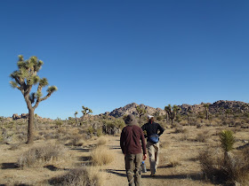 |
| On the way to Willow Hole |
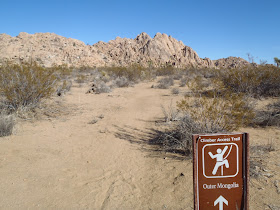 |
| Side Trail for Climbers Heading to Outer Mongolia |
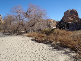 |
| Willow Hole |
View Willow Hole in a larger map
California Readers: Interested in getting paid to unplug your laptop or turn off a light for an hour? $20 just for joining OhmConnect, learn more at: https://login.ohmconnect.com/ref/30315
