Pages

Sunday, November 6, 2011

Lake Sequoyah Bike and Hike

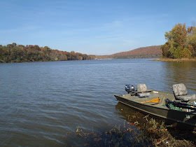
Today I biked out to Lake Sequoyah and hiked the Rookery Trail.  The bike ride out was ok, but not amazing.  The route has rolling hills, but nothing too step.  The main problem with biking to Lake Sequoyah (and Lake Weddington) is that MLK Blvd./Huntsville Rd./Hwy. 16 is a busy road without a dedicated bake lane or better yet a bike path alongside it.  Once I turned onto Lake Sequoyah Dr., the ride became much more enjoyable.
I parked my bike at the marina and went inside to get info on the trails around the lake.  There are at least two trails in the park, the Kingfisher and the Rookery.  The Kingfisher runs along the east side of the lake and begins north of the Marina.
Update 2/2014:  I believe it now goes around much of the north and west sides of the lake.

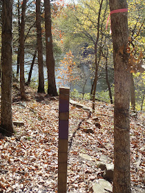
To get on the Rookery Trail, I crossed the road and walked south to the covered information sign.  This trail was hard to follow at times, but keep an eye out for light blue blazes and pink and orange flagging.  A few words of advice:
1.  A the first big open area, walk straight across the clearing and then look for blue blazes on the other side.
2.  At the second open area, after the second cattle gate, walk slightly to the left past the picnic table to the other side of the clearing to find the trail again.
3.  After the second clearing, the trail enters a wooded area and heads up a hill.  Be on the lookout for a gate in the fence (shown below).  If you miss this, you'll miss some of the most interesting parts of the trail (and you'll be lost).
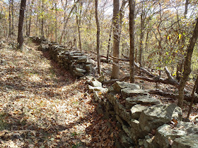
4.  This later section of this trail follows a VERY long rock wall which I hypothesize to be the long-lost ancient remains of the Great Wall of Arkansas.
5.  This is probably the most interesting trail I've been on in Fayetteville since moving here in August.  It is also probably the most difficult to follow.
6.  Wear good boots, the trail can be muddy and torn up by cattle in places, but the parts past that are worth it.
Lake Sequoyah, Fayetteville, Arkansas, Bike and HikeLake Sequoyah, Fayetteville, Arkansas, Bike and Hike
Lake Sequoyah, Fayetteville, Arkansas, Bike and Hike

View Lake Sequoyah Bike Hike in a larger map

Tuesday, November 1, 2011

Biking on Campus

UA is working to improve biking in and around campus, but with the topography, numerous construction sites, and more students every semester biking on campus can be quite intimidating.  The map below shows some routes that make biking around campus a more pleasant experience by avoiding steep hills and high pedestrian traffic areas.  For more details, click items on the map or click the link at the base of the map.

To make it easier for more students to bike (and not drive) the campus should:
1.  Build more bike racks at dorms and other locations where overflow has been witnessed.
2.  Mark designated bike lanes on some paths through campus and on major roads around campus like Maple St., Arkansas Ave., and Garland Ave.
3.  Close more roads through campus to non-essential vehicular traffic, at least during class hours.  Campuses feel more like campuses when there aren't lots of cars driving through them anyways.  If you've ever been on Ozark Ave. near the end of Dickson between classes, you know that cars shouldn't be trying to drive through there.  I think the rest of Garland and Ozark Ave. would be good places to start closing more roads.

For useful sites and more information on biking on campus read this.